1
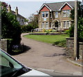
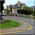
Entrance to Brondeg Day Centre, Blackwood
Caerphilly Council day centre set back from the north side of Bloomfield Road.
Image: © Jaggery
Taken: 17 May 2018
0.04 miles
2
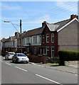
Telephone wires over Bloomfield Road, Blackwood
Image: © Jaggery
Taken: 17 May 2018
0.04 miles
3
Many solar panels on a Bloomfield Road roof, Blackwood
On the roof of Beatrice Webb Residential Home for Older People.
Image: © Jaggery
Taken: 17 May 2018
0.05 miles
4
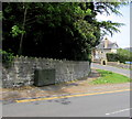
Ordnance Survey Cut Mark
This OS cut mark can be found on the wall NW side of Bloomfield Road. It marks a point 197.916m above mean sea level.
Image: © Adrian Dust
Taken: 5 Feb 2021
0.06 miles
5
Virgin Media telecoms cabinet, Bloomfield Road, Blackwood
Near the corner of Cefn Road.
Image: © Jaggery
Taken: 17 May 2018
0.07 miles
6
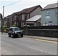
Bloomfield Road pavement, Blackwood
Descending towards the Cefn Road/South View Road crossroads.
Image: © Jaggery
Taken: 17 May 2018
0.07 miles
7
Top Cut hairdressing salon, Blackwood
Viewed across Cefn Road. The salon is near the corner of Bloomfield Road.
Image: © Jaggery
Taken: 17 May 2018
0.07 miles
8
Mount Pleasant Baptist Church direction sign on a Blackwood corner
On the corner of Bloomfield Road and Cefn Road.
Image: © Jaggery
Taken: 17 May 2018
0.07 miles
9
Allotments entrance gate, Attlee Road, Blackwood
The gate is set back from the east side of a bend in Attlee Road.
In 2018, Caerphilly County Borough has about 80 allotment sites,
with a total of more than 2000 plots under cultivation.
Image: © Jaggery
Taken: 17 May 2018
0.07 miles
10
Cefn Road houses and name sign, Blackwood
The sign near the corner of South View Road shows that this part of Cefn Road leads to
Hillside Terrace, Holly Place, Lewis Street, Mount Pleasant, Oak Street & Stanley Street.
Image: © Jaggery
Taken: 17 May 2018
0.08 miles


