1
The Little Theatre, Cefn Road, Blackwood
Image: © Roger Cornfoot
Taken: 10 May 2007
0.05 miles
2
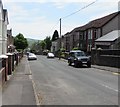
Down Cefn Road, Blackwood
Cefn Road descends towards the town centre. Viewed from the corner of South View Road.
Image: © Jaggery
Taken: 17 May 2018
0.06 miles
3
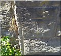
Ordnance Survey Cut Mark
This OS cut mark can be found on the wall post of the Baptist Chapel. It marks a point 181.307m above mean sea level.
Image: © Adrian Dust
Taken: 22 Jun 2019
0.06 miles
4
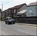
Wesley Road, Blackwood
Dead-end road above the west side of High Street.
Image: © Jaggery
Taken: 17 May 2018
0.08 miles
5
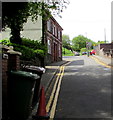
Top Cut hairdressing salon, Blackwood
Viewed across Cefn Road. The salon is near the corner of Bloomfield Road.
Image: © Jaggery
Taken: 17 May 2018
0.09 miles
6
Rhyd Developments Ltd name sign, Pentwyn Road, Blackwood
The name sign is on the wall near steps leading up to a door on the west side of Pentwyn Road in May 2018.
Image: © Jaggery
Taken: 17 May 2018
0.09 miles
7
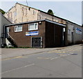
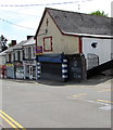
Vacant premises, Pentwyn Road, Blackwood
A Paul Fosh Auctions Sold board is on the wall of the vacant premises in May 2018.
An August 2011 Google Earth Street View shows Tydfil Training here.
The entrance to Black Sheep music, social and events hub is at the right edge of the photo.
Image: © Jaggery
Taken: 17 May 2018
0.09 miles
8
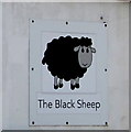
Black Sheep name sign, Pentwyn Road, Blackwood
On the wall on the right here. https://www.geograph.org.uk/photo/5788661
Image: © Jaggery
Taken: 17 May 2018
0.09 miles
9
Bloomfield Road pavement, Blackwood
Descending towards the Cefn Road/South View Road crossroads.
Image: © Jaggery
Taken: 17 May 2018
0.09 miles
10
Ordnance Survey Cut Mark
This OS cut mark can be found on the wall NW side of Bloomfield Road. It marks a point 197.916m above mean sea level.
Image: © Adrian Dust
Taken: 5 Feb 2021
0.09 miles


