1
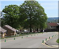
Albany Road, Blackwood
Houses on the west side of Albany Road, viewed from the Attlee Road / Woodbine Road junction.
Image: © Jaggery
Taken: 4 Apr 2011
0.02 miles
2
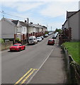
Albany Road and Attlee Road, Blackwood
A view along Albany Road into Attlee Road. The right turn just past
the bus stop into Woodbine Road is the point at which the name change occurs.
Image: © Jaggery
Taken: 1 May 2013
0.12 miles
3
Entrance to Blackwood Primary School
Viewed across Apollo Way.
Image: © Jaggery
Taken: 4 Apr 2011
0.13 miles
4
Two rows of green cones, Apollo Way, Blackwood
The cones mark the no parking/no stopping zone near the entrance to Blackwood Primary School.
Image: © Jaggery
Taken: 17 May 2018
0.14 miles
5
South along Coronation Road, Blackwood
Viewed from the corner of Woodbine Road.
Image: © Jaggery
Taken: 17 May 2018
0.15 miles
6
From 30 to 20 on Apollo Way, Blackwood
Near a speed bump, the 30mph speed limit drops to 20mph on the approach to Blackwood Primary School. PARTH is Welsh for ZONE. The green cones mark the Keep Clear Zone (no stopping or parking) near the school.
Image: © Jaggery
Taken: 17 May 2018
0.15 miles
7
From 20 to 30 on Apollo Way, Blackwood
The 20mph speed limit in force near Blackwood Primary School
increases to 30mph on the approach to the Attlee Road junction.
Image: © Jaggery
Taken: 17 May 2018
0.15 miles
8
Albany Road houses, Blackwood
Houses at the southern end of Albany Road, viewed from the corner of Gordon Road.
Image: © Jaggery
Taken: 1 May 2013
0.15 miles
9
Royal Mail drop box on the west side of Coronation Road, Blackwood
Image: © Jaggery
Taken: 17 May 2018
0.15 miles
10
West side of Parfitt Place, Blackwood
Parfitt Place is a cul-de-sac on the south side of Apollo Way.
Image: © Jaggery
Taken: 17 May 2018
0.15 miles


