1
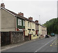
Springfield Terrace, Hollybush
Viewed from the corner of Banalog Terrace looking across the A4048 Newport Road, the main road through Hollybush, a small village north of Markham in Caerphilly County Borough.
Image: © Jaggery
Taken: 23 May 2017
0.01 miles
2
Springfield Terrace, Hollybush
Row of houses alongside the A4048 Newport Road, the main road through
Hollybush, a small village north of Markham in Caerphilly County Borough.
Image: © Jaggery
Taken: 23 May 2017
0.02 miles
3
Springfield Terrace, Hollybush
Viewed across the A4048 Newport Road, the main road through Hollybush, a small village north of Markham in Caerphilly County Borough. Springfield Terrace contains 8 houses.
Image: © Jaggery
Taken: 1 Aug 2013
0.02 miles
4
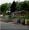
Glenview bus stop and shelter, Hollybush
This stop alongside the A4048 Newport Road is for Stagecoach buses on route 56 to Tredegar.
Image: © Jaggery
Taken: 23 May 2017
0.02 miles
5
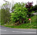
Vote Labour placard on a Hollybush corner
The white-on-red placard is on the corner of Newport Road and Banalog Terrace on May 23rd 2017, about a fortnight before the UK General Election.
Image: © Jaggery
Taken: 23 May 2017
0.02 miles
6
Rusty roof in Hollybush
Located here. http://www.geograph.org.uk/photo/5433411 A rusty roof makes a building easy to locate on satellite imagery.
Image: © Jaggery
Taken: 23 May 2017
0.02 miles
7
Lockup garages on the A4048 at Hollybush
Image: © Ian S
Taken: 25 May 2014
0.03 miles
8
Houses above Newport Road, Hollybush
The A4048 Newport Road is here on a shelf of flat land through a slope descending to the Sirhowy Valley.
Image: © Jaggery
Taken: 23 May 2017
0.03 miles
9
Steps from Newport Road, Hollybush
Four flights of steps crossing a zig-zag path (not fully visible) down from a roadside seating area on the main road, A4048.
Image: © M J Roscoe
Taken: 5 Oct 2016
0.03 miles
10
Banalog Terrace, Hollybush
Banalog Terrace ascends from the A4048 Newport Road.
Image: © Jaggery
Taken: 23 May 2017
0.03 miles


