IMAGES TAKEN NEAR TO
Markham, BLACKWOOD, NP12 0RZ

Introduction

This page details the photographs taken nearby to NP12 0RZ by members of the Geograph project.

The Geograph project started in 2005 with the aim of publishing, organising and preserving representative images for every square kilometre of Great Britain, Ireland and the Isle of Man.

There are currently over 7.5m images from over14,400 individuals and you can help contribute to the project by visiting https://www.geograph.org.uk

Image Map


Images are licensed for reuse under creativecommons.org/licenses/by-sa/2.0
Notes
  • Clicking on the map will re-center to the selected point.
  • The higher the marker number, the further away the image location is from the centre of the postcode.

Image Listing (11 Images Found)

Images are licensed for reuse under creativecommons.org/licenses/by-sa/2.0
Image
Details
Distance
1
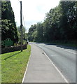
Trees beside the A4048 near Markham
Small areas of deciduous trees on the western side of the Sirhowy Valley give a pleasing contrast to the conifer plantations on the other side.
Image: © Robin Drayton Taken: 25 Oct 2011
0.07 miles
2
Northern boundary of Markham
The A4048 from Hollybush reaches Markham, a small village in Caerphilly County Borough.
Image: © Jaggery Taken: 1 Aug 2013
0.11 miles
3
The Markham village sign on the Newport Road
Image: © Ian S Taken: 24 May 2014
0.12 miles
4
Cycle route 467 just north of Markham
Cycle route, also for use by walkers and horses, heading north on a dismantled railway.
Image: © M J Roscoe Taken: 3 Jun 2016
0.14 miles
5
Along the Sirhowy valley
Image: © Alan Hughes Taken: 24 Feb 2024
0.17 miles
6
A4048 passes Pen-y-werlod Terrace, Markham
Pen-y-werlod Terrace is a 100 metre long row of houses set above the A4048 Newport Road.
Image: © Jaggery Taken: 1 Aug 2013
0.19 miles
7
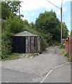
Lane on the NW side of a sharp bend in Abernant Road, Markham
The lane heads away from Abernant Road at the point where the road's orientation changes from NW-SE to SSW-NNW on its ascent from Newport Road to the centre of Markham village.
Image: © Jaggery Taken: 1 Aug 2013
0.20 miles
8
Pond near road junction on ridge
Pond partly covering track, Coed-y-Moeth Common.
Image: © M J Roscoe Taken: 5 Jul 2020
0.22 miles
9
Newport Road, Markham
Image: © Colin Pyle Taken: 2 Jan 2012
0.23 miles
10
Rough track across tunnel to site of former mine, Markham
The track goes from the A4048 across a short tunnel over the River Sirhowy to the site of a former coal mine on the other side of the valley.
Image: © M J Roscoe Taken: 3 Jun 2016
0.23 miles