1
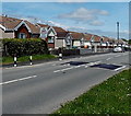
Markham Resource Centre, Markham
The former Markham police station in Heol-y-Bedw-Hirion is now Caerphilly County Borough Council premises in use as a base to support adults with learning disabilities.
Image: © Jaggery
Taken: 1 Jun 2013
0.01 miles
2
One-way system in Markham
A one-way system operates around this grass triangle.
Markham War Memorial http://www.geograph.org.uk/photo/3491246 is at the right edge of the triangle.
Image: © Jaggery
Taken: 1 Jun 2013
0.01 miles
3
Vacant site formerly Markham RFC clubhouse, Markham
Viewed across Heol-y-Bedw-Hirion. The site was until recently the location of the premises of Markham Rugby Football Club.
Image: © Jaggery
Taken: 1 Jun 2013
0.02 miles
4
Round and round we go, Markham
The mini-roundabout is at the junction of the B4511 Pantycefn Road and Heol-y-Bedw-Hirion.
Image: © Jaggery
Taken: 1 Jun 2013
0.02 miles
5
Markham War Memorial
Located on a triangular green on the south side of the B4511 Pantycefn Road.
Image: © Jaggery
Taken: 1 Jun 2013
0.03 miles
6
War Memorial, Markham (1)
Situated at a road junction on the western outskirts of Markham.
For a closer view see http://www.geograph.org.uk/photo/3912938 .
Image: © Robin Drayton
Taken: 1 Apr 2014
0.03 miles
7
War Memorial, Markham (2)
The three plaques name local residents who died in World War II, the Korean War and the Northern Ireland Troubles.
Image: © Robin Drayton
Taken: 1 Apr 2014
0.03 miles
8
Pantycefn Road bungalows, Markham
Semi-detached bungalows on the north side of the B4511 Pantycefn Road.
Image: © Jaggery
Taken: 1 Jun 2013
0.08 miles
9
Minor road from New Tredegar reaches Markham
At the NW edge of the village, the road is here named Heol-y-Bedw-Hirion.
Image: © Jaggery
Taken: 1 Jun 2013
0.09 miles
10
Cherry Trees, Markham
Viewed across Heol-y-Bedw-Hirion. Cherry Trees is a cul-de-sac at the NW edge of the village.
Image: © Jaggery
Taken: 1 Jun 2013
0.10 miles


