1
Abernant Road, Markham
This is the B4511 from Argoed as it enters Markham.
Image: © Robin Drayton
Taken: 8 Oct 2010
0.05 miles
2
The A4048 Newport Road near Markham
Image: © Ian S
Taken: 24 May 2014
0.08 miles
3
Berllanlwyd Avenue Markham
Berllanlwyd Avenue heads away from Abernant Road towards John Street.
Image: © Jaggery
Taken: 1 Jun 2013
0.08 miles
4
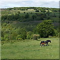
Horse and foal, Markham
Walking through a field on the north side of Abernant Road.
Image: © Jaggery
Taken: 1 Jun 2013
0.13 miles
5
Two short rows of single-storey houses, Markham
Viewed across Abernant Road.
Image: © Jaggery
Taken: 1 Jun 2013
0.15 miles
6
National Cycle Route 467, 'Manmoel Crossing'
The route, going north to Hollybush, crosses a minor road leading down to the River Sirhowy and a rough track up to Manmoel. There is access behind the camera to the route from the road.
Image: © M J Roscoe
Taken: 5 Oct 2016
0.17 miles
7
View under bridge carrying Sirhowy Valley Walk
A very narrow road leads down, then round a corner to reveal this view through the arch of the old bridge which used to carry a railway, but now has the Sirhowy Valley Walk crossing over it. The view is towards the Sirhowy Valley itself, though it is hard to make it out through all the trees.
Image: © Jessica Aidley
Taken: 5 Jul 2007
0.18 miles
8
Markham Miners Institute
The building in Abernant Road was formerly the main building of Markham Miners Institute.
It is now a community hall. There is a former coal dram (truck) http://www.geograph.org.uk/photo/3490506 on the lawn to commemorate Markham Colliery (1912-1986).
Image: © Jaggery
Taken: 1 Jun 2013
0.19 miles
9
Commemorative coal dram, Markham
The black dram (truck) commemorating Markham Colliery (1912-1986) is on the lawn here. http://www.geograph.org.uk/photo/3490498
Image: © Jaggery
Taken: 1 Jun 2013
0.19 miles
10
Ford/Watersplash across Sirhowy
This ford is just upstream of the road bridge. The bridge is very narrow so that farm vehicles and other large vehicles cannot use it.
Image: © Jessica Aidley
Taken: 5 Jul 2007
0.20 miles


