1
Ordnance Survey Cut Mark
This OS cut mark can be found on Melrose House, Woodfield Terrace. It marks a point 160.916m above mean sea level.
Image: © Adrian Dust
Taken: 9 Feb 2021
0.05 miles
2
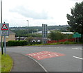
Woodfieldside boundary sign, Pontllanfraith
The green boundary sign is on the corner of Park Terrace and Woodfield Terrace.
Woodfieldside is a district of Pontllanfraith.
Image: © Jaggery
Taken: 8 Aug 2012
0.05 miles
3
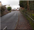
Park Terrace, Woodfieldside, Blackwood
Ascending from the Sirhowy River valley.
Image: © Jaggery
Taken: 18 Feb 2014
0.06 miles
4
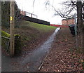
Path up from Park Terrace, Blackwood
Ascending towards Elm Court and Willow Drive.
Image: © Jaggery
Taken: 18 Feb 2014
0.06 miles
5
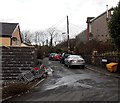
St Davids Avenue, Blackwood
Image: © Alex McGregor
Taken: 9 Jun 2010
0.07 miles
6
Woodfield Terrace, Pontllanfraith
A long row of houses on the east side of Woodfield Terrace in the Woodfieldside district of Pontllanfraith.
Image: © Jaggery
Taken: 8 Aug 2012
0.09 miles
7
Corner of Vale View Road and Yew Grove, Pontllanfraith
Houses in the Woodfieldside district of Pontllanfraith.
Image: © Jaggery
Taken: 8 Aug 2012
0.09 miles
8
New Road houses, Woodfieldside, Pontllanfraith
Fortunately there are prominent street name signs here to minimise confusion.
The address of the houses on the right is New Road. Those on the left are in Woodfield Street.
Image: © Jaggery
Taken: 8 Aug 2012
0.09 miles
9
Riverside Restaurant and Rock & Fountain pub, Blackwood
Viewed from the edge of the Sirhowy River. There are two names on the building, Riverside Restaurant and Rock & Fountain pub. The pub entrance is on the right.
An arrow points left towards the restaurant entrance up the steps.
Image: © Jaggery
Taken: 18 Feb 2014
0.10 miles
10
Southern end of St David's Avenue, Woodfieldside, Blackwood
Viewed from Park Terrace.
Image: © Jaggery
Taken: 18 Feb 2014
0.10 miles


