IMAGES TAKEN NEAR TO
Markham Crescent, BLACKWOOD, NP12 0JN

Introduction

This page details the photographs taken nearby to Markham Crescent, NP12 0JN by members of the Geograph project.

The Geograph project started in 2005 with the aim of publishing, organising and preserving representative images for every square kilometre of Great Britain, Ireland and the Isle of Man.

There are currently over 7.5m images from over14,400 individuals and you can help contribute to the project by visiting https://www.geograph.org.uk

Image Map


Images are licensed for reuse under creativecommons.org/licenses/by-sa/2.0
Notes
  • Clicking on the map will re-center to the selected point.
  • The higher the marker number, the further away the image location is from the centre of the postcode.

Image Listing (55 Images Found)

Images are licensed for reuse under creativecommons.org/licenses/by-sa/2.0
  • ...
Image
Details
Distance
1
Asheville, Oakdale
The residential street Asheville climbs away from Central Avenue.
Image: © Jaggery Taken: 8 Aug 2012
0.05 miles
2
Ordnance Survey Cut Mark
This OS cut mark can be found on the wall of the Old Hospital. Now No13 Penrhin. It marks a point 232.297m above mean sea level.
Image: © Adrian Dust Taken: 9 Feb 2021
0.07 miles
3
Oakdale Community Hospital
Opened in 1915.
Image: © Robin Drayton Taken: 5 Apr 2008
0.07 miles
4
Oakdale shops in The Square
Shops on the west side of The Square, the main shopping area in the village.
Image: © Jaggery Taken: 8 Aug 2012
0.07 miles
5
Oakdale Medical Centre
Located in The Square, on the corner of Beech Grove.
Image: © Jaggery Taken: 8 Aug 2012
0.08 miles
6
Oakdale Library
Located in The Square, the library is part of Caerphilly County Borough Council's library service. The current library was built during 2003 on the site formerly occupied by Bolwell's corner shops. The new library replaced the former library located in Llwynon Road, which itself was a replacement for the library formerly housed in the Institute.
Image: © Jaggery Taken: 8 Aug 2012
0.08 miles
7
Oakdale Rugby Club
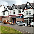
Oakdale RFC's social club is located in Central Buildings, on the east side of The Square.
Image: © Jaggery Taken: 8 Aug 2012
0.08 miles
8
Bus shelters near the southern edge of The Square, Oakdale
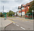
Viewed along Central Avenue. On the right is the derelict former Oakdale pub. http://www.geograph.org.uk/photo/3075949
Image: © Jaggery Taken: 8 Aug 2012
0.09 miles
9
Oakdale War Memorial, 11. 11. 2018
The stone memorial and its surroundings at the head of Central Avenue in the afternoon following the morning's Remembrance Service there in the centre of the original village.
Image: © M J Roscoe Taken: 11 Nov 2018
0.09 miles
10
Oakdale War Memorial
Located at the SW edge of The Square.
Image: © Jaggery Taken: 8 Aug 2012
0.09 miles
  • ...