1
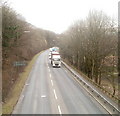
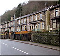
A467 south of a footbridge, Cwmcarn
The view SSE from a footbridge http://www.geograph.org.uk/photo/2261971 connecting with Commercial Road.
Image: © Jaggery
Taken: 7 Feb 2011
0.06 miles
2
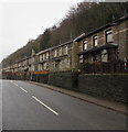
South along the A467, Cwmcarn
Viewed from this footbridge. http://www.geograph.org.uk/photo/5245317
Image: © Jaggery
Taken: 20 Dec 2016
0.08 miles
3
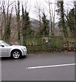
Newport Road electricity substation, Cwmcarn
The Western Power Distribution electricity substation is in a fenced enclosure on the west side of the B4591 Newport Road. Its identifier is NEWPORT RD SW SITE CWMCARN S/S No. 55-2226.
Image: © Jaggery
Taken: 7 Jan 2017
0.09 miles
4
From Newport Road to Commercial Road, Cwmcarn
Viewed across the B4591. The Newport Road name sign is on the right.
The Commercial Road name sign is a few metres to the left of it.
Image: © Jaggery
Taken: 7 Jan 2017
0.10 miles
5
English Baptist Church Sunday School, Abercarn
Grade II listed building on Commercial Road, alongside the church http://www.geograph.org.uk/photo/2261932 which is also Grade II listed.
Image: © Jaggery
Taken: 7 Feb 2011
0.10 miles
6
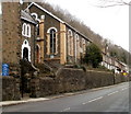
English Baptist Church, Abercarn
Grade II listed building on Commercial Road. The Sunday School, http://www.geograph.org.uk/photo/2261935 also Grade II listed, is on the right.
The boundary between Abercarn and Cwmcarn is unclear in this area. The church is on the Cwmcarn side of boundary signs on the adjacent A467.
Image: © Jaggery
Taken: 7 Feb 2011
0.10 miles
7
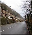
Houses above Commercial Road, Cwmcarn
The houses are at the edge of a hillside - Craig Llwyfas.
Image: © Jaggery
Taken: 20 Dec 2016
0.11 miles
8
Newport Road houses, Cwmcarn
Click http://www.geograph.org.uk/photo/5246663 for a closer view of the green nameplate on the right, a Risca Foundry final cast from May 2004.
Image: © Jaggery
Taken: 7 Jan 2017
0.11 miles
9
Risca Foundry final cast nameplate on a Newport Road house, Cwmcarn
The nameplate of number 8 Newport Road http://www.geograph.org.uk/photo/5246667 shows RISCA FOUNDRY FINAL CAST 28 MAY 2004.
Image: © Jaggery
Taken: 7 Jan 2017
0.11 miles
10
Houses above the B4591 Newport Road, Cwmcarn
The semi-detached houses on the east side of Newport Road are set a couple of metres above road level.
They face trees and a fence above the A467.
Image: © Jaggery
Taken: 7 Jan 2017
0.11 miles


