1
New Park Road enters Risca from Crosskeys
The Risca/Rhisga boundary sign https://www.geograph.org.uk/photo/5785130 is on the right.
Image: © Jaggery
Taken: 23 May 2018
0.02 miles
2
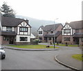
The Meadows, Crosskeys
Modern houses in a short cul-de-sac on the south side of Medart Place.
Image: © Jaggery
Taken: 11 Mar 2010
0.03 miles
3
Medart Place houses, Crosskeys
Houses on the north side of Medart Place, Crosskeys, just beyond the edge of Risca.
Image: © Jaggery
Taken: 11 Mar 2010
0.03 miles
4
Welcome to Crosskeys
The sign marks the boundary of Crosskeys and Risca. On crossing the border, Cromwell Road, Risca is renamed Medart Place, Crosskeys.
Image: © Jaggery
Taken: 11 Mar 2010
0.03 miles
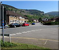
5
NE along Blackvein Road, Crosskeys
Looking to the northeast across New Park Road along Blackvein Road towards Medart Place.
The grey back of the Crosskeys boundary sign https://www.geograph.org.uk/photo/5785145 is on the left.
Image: © Jaggery
Taken: 23 May 2018
0.03 miles
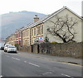
6
Blackvein Road semis, Crosskeys
Semi-detached houses on the approach to the Waunfawr Gardens junction. https://www.geograph.org.uk/photo/5785098
Image: © Jaggery
Taken: 23 May 2018
0.04 miles
7
Western boundary sign, Risca
On the south side of New Park Road. Risca is Rhisga in Welsh.
The Crosskeys boundary sign https://www.geograph.org.uk/photo/5785145 is behind the camera.
Image: © Jaggery
Taken: 23 May 2018
0.04 miles
8
Semis on a Crosskeys corner
Semi-detached houses on the corner of Blackvein Road and Waunfawr Gardens.
Image: © Jaggery
Taken: 23 May 2018
0.05 miles
9
New Park Road sign in a long hedge, Crosskeys
Near the corner of Blackvein Road.
Image: © Jaggery
Taken: 23 May 2018
0.05 miles
10
Outdated bus stop sign, Medart Place, Crosskeys
In May 2018, the bus stop sign near the corner of Blackvein Road shows three services operated by Glyn Williams. In 2006, the family firm sold their shares in Crosskeys Coach Hire, which traded as Glyn Williams Travel, to Red and White Services, a subsidiary of Stagecoach, who now operate the buses stopping here.
The white arrow on the small blue label on the bus stop pole points left towards Blackvein Road for National Cycle Network Route 47, a mainly inland route from the city of Newport to Fishguard via Neath and Carmarthen.
Image: © Jaggery
Taken: 23 May 2018
0.05 miles


