1
Semis on a Crosskeys corner
Semi-detached houses on the corner of Blackvein Road and Waunfawr Gardens.
Image: © Jaggery
Taken: 23 May 2018
0.00 miles
2
Ivy-clad houses, Medart Place, Crosskeys
A row of semi-detached houses on the north side of the B4591. The houses in the middle of the row face Black Vein Road. http://www.geograph.org.uk/photo/1759685
Image: © Jaggery
Taken: 10 Apr 2011
0.01 miles
3
Corner of Medart Place and Blackvein Road, Crosskeys
I haven't yet found out if the front part of the house on the corner has any connection with Black Vein Colliery (a former lodge, perhaps?)
Blackvein Road on the left formerly led to Black Vein Colliery. It was worked fully between 1841 and 1888 until the North Risca Colliery (Crosskeys) was opened. It then operated intermittently until the 1920s.
Black Vein was extremely gaseous in some sections, and became known as the "Death Pit" because of the number of explosions. Between 1846 and 1860 explosions killed 194 miners. The deadliest explosion was in December 1860 when 146 were killed.
Image: © Jaggery
Taken: 11 Mar 2010
0.01 miles
4
Mynydd Y Lan in the distance, Medart Place, Crosskeys
Medart Place (B4591) heads away from the turning for The Meadows. http://www.geograph.org.uk/photo/1759297
In the distance is Mynydd Y Lan (385 metres or 1,263 feet).
Image: © Jaggery
Taken: 11 Mar 2010
0.01 miles
5
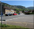
West along Waunfawr Gardens, Crosskeys
The sign on the corner of Blackvein Road shows that Waunfawr Gardens is not a through route.
The eastern edge of Coleg Gwent Crosskeys Campus is behind the houses in the background.
Image: © Jaggery
Taken: 23 May 2018
0.02 miles
6
NE along Blackvein Road, Crosskeys
Looking to the northeast across New Park Road along Blackvein Road towards Medart Place.
The grey back of the Crosskeys boundary sign https://www.geograph.org.uk/photo/5785145 is on the left.
Image: © Jaggery
Taken: 23 May 2018
0.02 miles
7
Blackvein Road semis, Crosskeys
Semi-detached houses on the approach to the Waunfawr Gardens junction. https://www.geograph.org.uk/photo/5785098
Image: © Jaggery
Taken: 23 May 2018
0.02 miles
8
New Park Road sign in a long hedge, Crosskeys
Near the corner of Blackvein Road.
Image: © Jaggery
Taken: 23 May 2018
0.03 miles
9
Western boundary sign, Risca
On the south side of New Park Road. Risca is Rhisga in Welsh.
The Crosskeys boundary sign https://www.geograph.org.uk/photo/5785145 is behind the camera.
Image: © Jaggery
Taken: 23 May 2018
0.04 miles
10
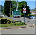
Crosskeys boundary sign near Waunfawr Park
The sign suggests that Crosskeys does not have a different name in Welsh.
The boundary sign https://www.geograph.org.uk/photo/5785130 behind the camera shows that Risca is Rhisga in Welsh.
Image: © Jaggery
Taken: 23 May 2018
0.04 miles


