IMAGES TAKEN NEAR TO
Park Road, NEWPORT, NP11 6PW

Introduction

This page details the photographs taken nearby to Park Road, NP11 6PW by members of the Geograph project.

The Geograph project started in 2005 with the aim of publishing, organising and preserving representative images for every square kilometre of Great Britain, Ireland and the Isle of Man.

There are currently over 7.5m images from over14,400 individuals and you can help contribute to the project by visiting https://www.geograph.org.uk

Image Map


Images are licensed for reuse under creativecommons.org/licenses/by-sa/2.0
Notes
  • Clicking on the map will re-center to the selected point.
  • The higher the marker number, the further away the image location is from the centre of the postcode.

Image Listing (240 Images Found)

Images are licensed for reuse under creativecommons.org/licenses/by-sa/2.0
  • ...
Image
Details
Distance
1
Park Road, Risca
Looking across Park Road towards Terry Howell DIY.
Image: © Jaggery Taken: 28 Apr 2018
0.01 miles
2
Tredegar Grounds, Risca
Tredegar Grounds was donated to the town of Risca by Lord Tredegar to commemorate Queen Victoria's Diamond Jubilee in 1897. The roughly triangular shaped park is bounded by Tredegar Street, Park Road and Station Road. This view is from the SW corner alongside Tredegar Street.
Image: © Jaggery Taken: 21 Jan 2014
0.03 miles
3
Ordnance Survey Cut Mark
This OS cut mark can be found on the NW parapet of the Railway Bridge. It marks a point 62.790m above mean sea level.
Image: © Adrian Dust Taken: 11 May 2019
0.03 miles
4
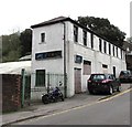
Former Lexon Group premises, Park Road, Risca
Boarded-up premises viewed in April 2018 when Lexon Group are based in Rush Drive, Crumlin.
Image: © Jaggery Taken: 28 Apr 2018
0.04 miles
5
Risca Play Zone
Children's play area on the west side of the park named Tredegar Grounds.
Image: © Jaggery Taken: 21 Jan 2014
0.04 miles
6
The Fox and Hounds, Pontymister
Image: © John Lord Taken: 10 Feb 2009
0.05 miles
7
Moriah Baptist Church, Risca
On the corner of Tredegar Street and Park Road. Opened in 1894.
Image: © Robin Drayton Taken: 22 Mar 2010
0.05 miles
8
Yellow-eyed litter bin in Risca Play Zone
Located here. http://www.geograph.org.uk/photo/3822078 I wondered if a very young child might find this bin too scary...
Image: © Jaggery Taken: 21 Jan 2014
0.05 miles
9
Tredegar Street public toilets in Risca
Located between Moriah Baptist Church http://www.geograph.org.uk/photo/1748769 and Risca Play Zone. http://www.geograph.org.uk/photo/3822078
Image: © Jaggery Taken: 21 Jan 2014
0.06 miles
10
West side of Grade II listed Moriah Baptist Church, Risca
This is the Tredegar Street side of the church on the corner of Park Road. See http://www.geograph.org.uk/photo/1748769 for the Park Road side and some details. The building was Grade II listed in 1999.
Image: © Jaggery Taken: 20 Dec 2016
0.06 miles
  • ...