1
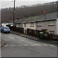
Housing in Abercarn
Image: © Alan Hughes
Taken: 12 Jun 2022
0.03 miles
2
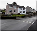
Coed Moelfa Road
Image: © Alan Hughes
Taken: 12 Jun 2022
0.07 miles
3
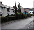
Llanfach Road houses, Llanfach, Abercarn
Houses on the south side of Llanfach Road, near the Bryn Road junction.
Image: © Jaggery
Taken: 7 Jan 2017
0.07 miles
4
Wires over Llanfach Road, Llanfach, Abercarn
Wires radiate from the pole at various levels. Patchy low cloud or
mist shrouds part of the distant hillside at 11am on January 7th 2017.
Image: © Jaggery
Taken: 7 Jan 2017
0.08 miles
5
Low pitched sloping roofs, Llanfach, Abercarn
Houses on the south side of Llanfach Road.
Image: © Jaggery
Taken: 7 Jan 2017
0.09 miles
6
Up Llanfach Road, Llanfach, Abercarn
Llanfach Road ascends from the Bryn Road junction.
Image: © Jaggery
Taken: 7 Jan 2017
0.09 miles
7
Ordnance Survey Rivet
This OS rivet can be found on the step of the Sub-Station on Gwyddon Road. It marks a point 126.169m above mean sea level.
Image: © Adrian Dust
Taken: 16 Aug 2021
0.09 miles
8
Houses on the north side of Llanfach Road, Llanfach, Abercarn
Looking past the Bryn Road http://www.geograph.org.uk/photo/5251978 junction.
Image: © Jaggery
Taken: 7 Jan 2017
0.09 miles
9
Llanfach Road approaches the Bryn Road junction, Llanfach, Abercarn
Part of the long steep ascent through the Llanfach area of Abercarn.
Image: © Jaggery
Taken: 7 Jan 2017
0.10 miles
10
Gwyddon Road and Upper Gwyddon Road, Abercarn
Upper Gwyddon Road on the left merges with Gwyddon Road on the far side of the red stand-mounted postbox. The houses in the two roads are numbered in the same sequence - the lowest numbers are allocated to Gwyddon Road houses out of shot to the west http://www.geograph.org.uk/photo/2243401 and the sequence is continued with the westernmost house on Upper Gwyddon Road.
Image: © Jaggery
Taken: 23 Jan 2011
0.10 miles


