1
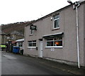
Abercarn Workingmen's Club & Institute, Market Place, Abercarn
At the eastern end of Market Place near school entrance gates. http://www.geograph.org.uk/photo/5256775
Image: © Jaggery
Taken: 14 Jan 2017
0.01 miles
2
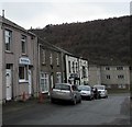
Morris Racing betting shop, Market Place, Abercarn
The Morris Racing nameboard shows Horseracing - Greyhounds - Football - Rugby.
Image: © Jaggery
Taken: 14 Jan 2017
0.01 miles
3
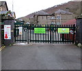
School entrance gates, Market Place, Abercarn
At the eastern end of Market Place, about 60 metres east of High Street, the gates are at
the entrance to Ysgol Gymraeg Cwm Gwyddon, http://www.geograph.org.uk/photo/5256769 a Welsh medium primary school.
Image: © Jaggery
Taken: 14 Jan 2017
0.01 miles
4
The Commercial Inn and Market Tavern, Abercarn
Market Place pubs viewed from the corner of High Street.
Image: © Jaggery
Taken: 14 Jan 2017
0.02 miles
5
The Commercial Inn name sign, Abercarn
The name sign on this wall http://www.geograph.org.uk/photo/5256802 is similar to the small sign http://www.geograph.org.uk/photo/2242809 hanging from a wall bracket nearby.
Image: © Jaggery
Taken: 14 Jan 2017
0.03 miles
6
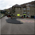
Ysgol Gymraeg Cwm Gwyddon, Abercarn
Welsh medium primary school viewed from the Market Place entrance gates. http://www.geograph.org.uk/photo/5256775
The School Guide website states that this school serves a large area including Newbridge, Abercarn, Cwmcarn, Risca and Hafodyrynys. The school has 242 pupils between the ages of 3 and 11, including 26 nursery age children and 15 pre-nursery age children. Pupils start here at the beginning of the term after their third birthday. 98% per cent of the pupils are from white ethnic backgrounds. About 6% come from Welsh-speaking homes.
Image: © Jaggery
Taken: 14 Jan 2017
0.03 miles
7
Gwyddon Road, Abercarn
Image: © Roger Cornfoot
Taken: 3 May 2007
0.03 miles
8
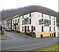
Two pubs, Abercarn
Neighbours on Market Place are The Commercial Inn, on the corner of High Street and for sale, and Market Tavern.
Image: © Jaggery
Taken: 23 Jan 2011
0.03 miles
9
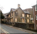
Former Abercarn police station
A boarded-up former police station located on Gwyddon Road near its junction with High Street.
A Gwent Police report in 2010 stated that the police station had not been used for some time. PACT (Police and Community Trust) meetings are held in Ysgol Gymraeg Cwm Gwyddon, and police surgeries are held in Abercarn library or Cwmcarn Institute.
Image: © Jaggery
Taken: 24 Jan 2011
0.03 miles
10
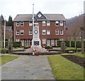
Abercarn War Memorial
Viewed from High Street. The War Memorial is between Gwyddon Road and Market Place.
This view http://www.geograph.org.uk/photo/423423 of Gwyddon Road shows the War Memorial from another angle.
Gwyddon Court http://www.geograph.org.uk/photo/2303251 is behind the memorial.
Image: © Jaggery
Taken: 23 Jan 2011
0.03 miles


