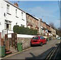
IMAGES TAKEN NEAR TO
Gladstone Road, NEWPORT, NP11 5EN

Introduction

This page details the photographs taken nearby to Gladstone Road, NP11 5EN by members of the Geograph project.

The Geograph project started in 2005 with the aim of publishing, organising and preserving representative images for every square kilometre of Great Britain, Ireland and the Isle of Man.

There are currently over 7.5m images from over14,400 individuals and you can help contribute to the project by visiting https://www.geograph.org.uk

Image Map


Images are licensed for reuse under creativecommons.org/licenses/by-sa/2.0
Notes
  • Clicking on the map will re-center to the selected point.
  • The higher the marker number, the further away the image location is from the centre of the postcode.

Image Listing (120 Images Found)

Images are licensed for reuse under creativecommons.org/licenses/by-sa/2.0
  • ...
Image
Details
Distance
1
Swffryd
Swffryd from the air (this is the site of the original Crumlin viaduct, made famous by the film 'Arabesque' starring Gregory Peck and Sopia Loren). Thanks to Mike Hale for the info.
Image: © phil matthews Taken: 9 Dec 2005
0.02 miles
2
Western end of Gladstone Road, Crumlin
Looking ENE in the direction of Hafodyrynys Road.
Image: © Jaggery Taken: 17 Feb 2011
0.02 miles
3
Station Road, Crumlin
Taken from the eastern entrance to the road tunnel under the A467. The stone building with a brown door and windows is now a house, formerly St Mary's Church.
Image: © M J Roscoe Taken: 14 Jan 2016
0.05 miles
4
Culvert, Hafod-yr-ynys Road, Crumlin
Entrance to culvert for a tributary stream of the River Ebbw. The ladder goes up towards the road.
Image: © M J Roscoe Taken: 18 Aug 2016
0.06 miles
5
Track down to Hafod-yr-ynys Road, Crumlin
The start of the hillside track shown in Image; the row of houses in the background is on Gladstone Road.
Image: © M J Roscoe Taken: 18 Aug 2016
0.06 miles
6
Ordnance Survey Cut Mark
This OS cut mark can be found on the east angle of St Mary's Church. It marks a point 127.553m above mean sea level.
Image: © Adrian Dust Taken: 11 May 2019
0.06 miles
7
Part of the long ascent from Crumlin to Hafodyrynys
Viewed past the left turn for Gladstone Road, Hafodyrynys Road ascends away from Crumlin.
Image: © Jaggery Taken: 17 Feb 2011
0.06 miles
8
Northward in Ebbw Valley at site of Crumlin Viaduct, 1990
View NE to Swffryd, over the site of the former Crumlin Viaduct, some residual piers of which can be seen. Demolished in 1967, the viaduct carried the ex-GW Pontypool Road (to the right) - Aberdare - Neath line, which was closed on 15/6/1964, across the valley and the Newport - Ebbw Vale/Brynmawr line at Crumlin (Low Level). See Image
Image: © Ben Brooksbank Taken: 19 May 1990
0.06 miles
9
Ordnance Survey Rivet
This OS rivet can be found on the wall at the road junction. It marks a point 145.752m above mean sea level.
Image: © Adrian Dust Taken: 11 May 2019
0.07 miles
10
Gladstone Road, Crumlin
Houses on the north side of Gladstone Road, a cul-de-sac connecting with Hafodyrynys Road (behind the camera).
Image: © Jaggery Taken: 17 Feb 2011
0.07 miles
  • ...