1
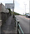
Ystrad Mynach and Swffryd direction signs, Hafodyrynys
Alongside the A472 on the approach to this https://www.geograph.org.uk/photo/5647499 junction.
Image: © Jaggery
Taken: 8 Sep 2017
0.01 miles
2
Late Victorian name tablet on Herbert Terrace, Hafodyrynys
Viewed across the A472. The inscription on the tablet at first floor level is HERBERT TERRACE 1892.
Image: © Jaggery
Taken: 8 Sep 2017
0.02 miles
3
Speed camera warning sign, Hafodyrynys
Alongside the A472 on the western approach to Hafodyrynys.
Image: © Jaggery
Taken: 8 Sep 2017
0.02 miles
4
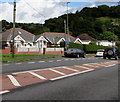
Hafodyrynys bungalows
Alongside the A472, the main road through Hafodyrynys. Originally, bungalow was used in English for a lightly-built house, with a veranda and one storey. In current UK usage it is a convenient word for any one-storey dwelling.
Image: © Jaggery
Taken: 8 Sep 2017
0.02 miles
5
Edge of Coed Llwyn-du
A few metres south of the A472, Hafodyrynys, the road to Pantside reaches the edge
of woodland (Coed Llwyn-du).
Image: © Jaggery
Taken: 16 Aug 2010
0.03 miles
6
Hafodyrynys : country road to Pantside unsuitable for HGVs
A blue sign at the start of a steep climb from the A472 into Coed Llwyn-du advises drivers of HGVs (heavy goods vehicles) that the road ahead is unsuitable.
Image: © Jaggery
Taken: 16 Aug 2010
0.03 miles
7
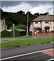
Dark green lockup garages, Hafodyrynys
Two corrugated metal lockup garages viewed across the A472, the main road through Hafodyrynys.
Image: © Jaggery
Taken: 8 Sep 2017
0.03 miles
8
Cottages at Hafodyrynys
The picture shows the A472 running past this row of cottages. At rush hours this road is exceedingly busy.
Image: © Jessica Aidley
Taken: 6 Jul 2007
0.03 miles
9
Path to the village hall, Hafodyrynys
From the A472 to Hafodyrynys Village Hall. http://www.geograph.org.uk/photo/5529734
Image: © Jaggery
Taken: 8 Sep 2017
0.04 miles
10
Hafodyrynys houses
A mixture of two-storey semis and detached bungalows on the north side of the A472, Hafodyrynys.
Image: © Jaggery
Taken: 16 Aug 2010
0.04 miles


