1
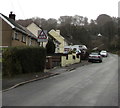
Twyn Road towards a children's playground, Llanfach, Abercarn
The road ascends past a playground warning sign.
Image: © Jaggery
Taken: 7 Jan 2017
0.04 miles
2
Field and trees beyond the NE end of Llanfach Road, Llanfach, Abercarn
Viewed from the fence here. http://www.geograph.org.uk/photo/5252461
Image: © Jaggery
Taken: 7 Jan 2017
0.05 miles
3
Ordnance Survey Cut Mark
This OS cut mark can be found on the gatepost of Abercarn Cemetery on Cemetery Road. It marks a point 195.499m above mean sea level.
Image: © Adrian Dust
Taken: 16 Aug 2021
0.07 miles
4
Yellow grit box at the NE end of Llanfach Road, Llanfach, Abercarn
Llanfach Road ends here, 650 metres from its other end at the Twyn Road junction. http://www.geograph.org.uk/photo/5251967
Image: © Jaggery
Taken: 7 Jan 2017
0.07 miles
5
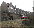
Tree and houses at the NE end of Llanfach Road, Llanfach, Abercarn
The road ends on the right. http://www.geograph.org.uk/photo/5252461
Image: © Jaggery
Taken: 7 Jan 2017
0.07 miles
6
Llanfach, Abercarn
Viewed above Cwm Gwyddon from Rhyswg Fawr. The southern part of Newbridge is top left.
Image: © M J Roscoe
Taken: 14 Oct 2020
0.07 miles
7
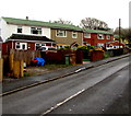
Green roofs, Llanfach Road, Llanfach, Abercarn
Houses near the NE end of Llanfach Road.
Image: © Jaggery
Taken: 7 Jan 2017
0.08 miles
8
Penrhiw Terrace, Abercarn
Viewed from the Cemetery Road end. This section of Penrhiw Terrace runs parallel with Persondy Terrace, http://www.geograph.org.uk/photo/2286422 a few metres beyond the right edge of the view.
Image: © Jaggery
Taken: 24 Jan 2011
0.09 miles
9
Persondy Terrace, Abercarn
Semi-detached houses viewed from the north end of Cemetery Road.
Image: © Jaggery
Taken: 24 Jan 2011
0.09 miles
10
Down Llanfach Road, Llanfach, Abercarn
From the edge of this fence and field, http://www.geograph.org.uk/photo/5252461 Llanfach Road descends into the Llanfach area of Abercarn.
Image: © Jaggery
Taken: 7 Jan 2017
0.09 miles


