IMAGES TAKEN NEAR TO
Mount Pleasant, NEWPORT, NP11 4SH

Introduction

This page details the photographs taken nearby to Mount Pleasant, NP11 4SH by members of the Geograph project.

The Geograph project started in 2005 with the aim of publishing, organising and preserving representative images for every square kilometre of Great Britain, Ireland and the Isle of Man.

There are currently over 7.5m images from over14,400 individuals and you can help contribute to the project by visiting https://www.geograph.org.uk

Image Map


Images are licensed for reuse under creativecommons.org/licenses/by-sa/2.0
Notes
  • Clicking on the map will re-center to the selected point.
  • The higher the marker number, the further away the image location is from the centre of the postcode.

Image Listing (158 Images Found)

Images are licensed for reuse under creativecommons.org/licenses/by-sa/2.0
  • ...
Image
Details
Distance
1
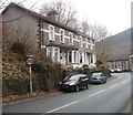
Rock Villas, Abercarn
Two semi-detached houses located at the NE edge of High Street. A stone inscription between the third and fourth upstairs windows shows ROCK 1894 VILLAS.
Image: © Jaggery Taken: 23 Jan 2011
0.02 miles
2
Garn Street, Abercarn
Dead-end street descending from the west side of the B4591 High Street to railings above the A467.
Image: © Jaggery Taken: 7 Jan 2017
0.03 miles
3
Solar panels on a Bridge Street house, Abercarn
Optimally located on a south facing roof.
Image: © Jaggery Taken: 20 Dec 2016
0.04 miles
4
High Street houses alongside a bend, Abercarn
The houses are on the west side of the B4591 High Street.
Image: © Jaggery Taken: 7 Jan 2017
0.05 miles
5
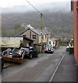
Houses above the east side of Bridge Street, Abercarn
A bricked-up arch is in the wall on the right.
Image: © Jaggery Taken: 20 Dec 2016
0.05 miles
6
X18 bus in Bridge Street, Abercarn
The Stagecoach bus is on route X18 from Ebbw Vale to Newport.
Image: © Jaggery Taken: 20 Dec 2016
0.06 miles
7
High Street
Image: © Colin Pyle Taken: 2 Jan 2012
0.07 miles
8
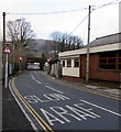
SLOW/ARAF on the approach to traffic lights, Bridge Street, Abercarn
The traffic lights maintain an alternating flow of one-way traffic on the road under the bridge.
Image: © Jaggery Taken: 20 Dec 2016
0.07 miles
9
Abercarn Post Office
21 High Street.
Image: © Jaggery Taken: 23 Jan 2011
0.07 miles
10
The Malt House, Abercarn
Located on High Street next door to the post office. http://www.geograph.org.uk/photo/2303205 A malt house (or maltings) was used to store and prepare malt (barley or other grain prepared for brewing or distilling). The building is now divided into three private residences.
Image: © Jaggery Taken: 23 Jan 2011
0.07 miles
  • ...