IMAGES TAKEN NEAR TO
High Street, NEWPORT, NP11 4HG
Introduction
This page details the photographs taken nearby to High Street, NP11 4HG by members of the Geograph project.
The Geograph project started in 2005 with the aim of publishing, organising and preserving representative images for every square kilometre of Great Britain, Ireland and the Isle of Man.

There are currently over 7.5m images from over14,400 individuals and you can help contribute to the project by visiting https://www.geograph.org.uk
Image Map
Images are licensed for reuse under creativecommons.org/licenses/by-sa/2.0
Notes
- Clicking on the map will re-center to the selected point.
- The higher the marker number, the further away the image location is from the centre of the postcode.
Image Listing (75 Images Found)
Images are licensed for reuse under creativecommons.org/licenses/by-sa/2.0
Image
Details
Distance
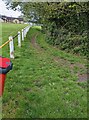
1
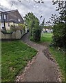
Zigzag path, Pentwynmawr
From the south side of Coed Duon View, the path leads to an entrance to Pentwynmawr Recreation Ground.
Image: © Jaggery
Taken: 5 May 2022
0.06 miles
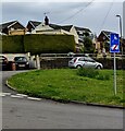
2
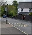
Coed Duon View bus stop, Pentwynmawr
Alongside High Street near the corner of Coed Duon View. In May 2022 this is a stop on Stagecoach bus route 151 to Newport and route 21 to Cwmbran.
Image: © Jaggery
Taken: 5 May 2022
0.06 miles
3
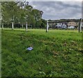
Gap in a perimeter fence / railing, Pentwynmawr
At the northern edge of Pentwynmawr Recreation Ground in May 2022.
Image: © Jaggery
Taken: 5 May 2022
0.07 miles
4
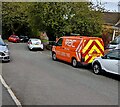
Orange RAC van, Pentwynmawr
Parked on the Coed Duon View roadway in May 2022.
Image: © Jaggery
Taken: 5 May 2022
0.07 miles
5
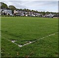
Football pitch, Pentwynmawr
Part of Pentwynmawr Recreation Ground.
Image: © Jaggery
Taken: 5 May 2022
0.07 miles
6
Track past the edge of a football pitch, Pentwynmawr
The track is on the north side of Pentwynmawr Recreation Ground.
Image: © Jaggery
Taken: 5 May 2022
0.07 miles
7
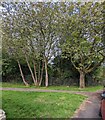
Tree-lined path edge, Pentwynmawr
Viewed from the Coed Duon View pavement.
The path leads to Pentwynmawr Recreation Ground.
Image: © Jaggery
Taken: 5 May 2022
0.07 miles
8
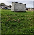
Dugout at the edge of football pitch, Pentwynmawr
This dugout is a covered bench area at the northern edge of Pentwynmawr Recreation Ground.
Image: © Jaggery
Taken: 5 May 2022
0.07 miles
9
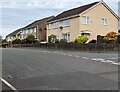
Coed Duon View houses, Pentwynmawr
The Caerbryn junction is on the right.
Image: © Jaggery
Taken: 5 May 2022
0.07 miles
10
Ignore satnav sign, Coed Duon View, Pentwynmawr
On a pole on grass near the corner of King Charles Road.
Image: © Jaggery
Taken: 5 May 2022
0.08 miles