1
Pentwynmawr boundary sign on High Street
Image: © Colin Pyle
Taken: 2 Jan 2012
0.07 miles
2
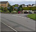
King Charles Road, Pentwynmawr
Viewed across Coed Duon View.
Image: © Jaggery
Taken: 5 May 2022
0.10 miles
3
House on private lane off Pennar Lane
A public footpath, going towards the camera, starts from Pennar Lane at the dog waste bin. The sign bans motor cycles from the path.
Image: © M J Roscoe
Taken: 21 May 2020
0.10 miles
4
Red bin for dog waste, Pentwynmawr
Near the corner of Coed Duon View and High Street.
Image: © Jaggery
Taken: 5 May 2022
0.12 miles
5
Disused tunnel at Ton-y-pistyll, Newbridge, Caerphilly
The railway between Risca in the Ebbw Valley and Markham Colliery in the Sirhowy Valley passed under the A472 (now unclassified) at Ton-y-pistyll, by means of the 239 yds-long Penar Tunnel. This is the east portal of the tunnel.
Image: © Ralph Rawlinson
Taken: 18 Feb 2006
0.12 miles
6
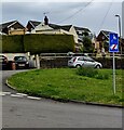
Junction of Coed Duon View and King Charles Road, Pentwynmawr
Viewed across Coed Duon View in May 2022.
Image: © Jaggery
Taken: 5 May 2022
0.12 miles
7
Former trackbed west of bridge on Pennar Lane
Part of the trackbed in a cutting has been converted apparently to a woodland garden for an adjacent house on the outskirts of Pentwyn-mawr.
Image: © M J Roscoe
Taken: 21 May 2020
0.13 miles
8
Bridge portal, Pennar Lane
Eastern side of road bridge over former railway (Crumlin to Pontllanfraith).
Image: © M J Roscoe
Taken: 21 May 2020
0.13 miles
9
Ignore satnav sign, Coed Duon View, Pentwynmawr
On a pole on grass near the corner of King Charles Road.
Image: © Jaggery
Taken: 5 May 2022
0.13 miles
10
Caerbryn, Pentwynmawr
Caerbryn ascends away from the north side of Coed Duon View.
Image: © Jaggery
Taken: 5 May 2022
0.13 miles


