1
The view south from Newbridge railway station
The single-track railway line is crossed by the Calzaghe bridge,http://www.geograph.org.uk/photo/1931353 opened in September 2009.
Image: © Jaggery
Taken: 23 Jun 2010
0.01 miles
2
Ebbw Valley Line, Celynen Road, Newbridge
Railway immediately south of station; the bus is on Celynen Road and one of the ramps of the Calzaghe footbridge is on the left. The row of houses to the right of the bus are on Ebbw Terrace
Image: © M J Roscoe
Taken: 11 Mar 2017
0.01 miles
3
Golden Grove, Newbridge
Viewed across Celynen Road. There are four Golden Grove houses on the side facing the camera.
Also in Golden Grove, out of shot around the corner, are a church http://www.geograph.org.uk/photo/3073559 and another four houses.
Ebbw View Terrace http://www.geograph.org.uk/photo/3073675 is in the background.
Image: © Jaggery
Taken: 8 Aug 2012
0.01 miles
4
Golden Grove houses, Newbridge
Row of four houses viewed across Celynen Road.
Other Golden Grove houses http://www.geograph.org.uk/photo/4667790 are around the corner on the right.
Image: © Jaggery
Taken: 18 Sep 2015
0.01 miles
5
Pentecostal Church, Newbridge
The Pentecostal Church (Assemblies Of God) is located in Golden Grove.
Image: © Jaggery
Taken: 8 Aug 2012
0.02 miles
6
Golden Grove, Newbridge
Ascending from Celynen Road. A Pentecostal Church http://www.geograph.org.uk/photo/3073559 is in the background on the left.
Image: © Jaggery
Taken: 18 Sep 2015
0.02 miles
7
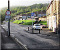
Low bridge warning sign and traffic calming, Celynen Road, Newbridge
The sign gives advance warning of a bridge with 11ft headroom a mile and a quarter ahead.
Traffic ahead has priority over oncoming vehicles past the roadway narrowing.
Image: © Jaggery
Taken: 18 Sep 2015
0.02 miles
8
Steps up to Torlais Street, Newbridge
From Celynen Road.
Image: © Jaggery
Taken: 18 Sep 2015
0.03 miles
9
Recently added piles of lineside ballast near Newbridge railway station
Viewed in September 2015 when work on doubling the track between Crosskeys Junction and Aberbeeg Junction has begun. When complete, the double track will enable a more frequent service on the Ebbw Vale line, currently a maximum of one train per hour in each direction.
Behind the camera, some track support sleepers are already in place. http://www.geograph.org.uk/photo/4665646
Image: © Jaggery
Taken: 18 Sep 2015
0.03 miles
10
Torlais Street, Newbridge
Viewed from the corner of Hill Street. The long row of houses contains numbers 23 to 1 Torlais Street. The other four houses, numbers 24 to 27, are behind the camera.
Image: © Jaggery
Taken: 8 Aug 2012
0.04 miles


