1
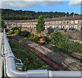
Back lane in Newbridge
South from High Street past the backs of houses in Ebbw View Terrace on the left.
Image: © Jaggery
Taken: 30 Jul 2019
0.01 miles
2
Yellow Flannery excavator, Newbridge
In July 2023 work is in progress on creating a second track
and second platform at Newbridge station behind the camera.
Image: © Jaggery
Taken: 19 Jul 2023
0.02 miles
3
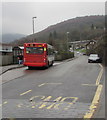
X18 bus in Newbridge
The Stagecoach single-decker, fleet number 35204, is at a Celynen Road
bus stop in the centre of Newbridge. It is on route X18 from Ebbw Vale to Newport.
Image: © Jaggery
Taken: 9 Dec 2016
0.02 miles
4
Ebbw View Terrace bus stop and shelter, Newbridge
In December 2016, the bus stop sign shows (route) N2 to Llanfach, X15 and X18, both to Newport.
Image: © Jaggery
Taken: 15 Dec 2016
0.02 miles
5
X15 bus in Newbridge
The Stagecoach bus on route X15 from Brynmawr stops briefly at the Ebbw View Terrace bus stop
on Celynen Road to let off one passenger before continuing towards Newport.
Image: © Jaggery
Taken: 15 Dec 2016
0.02 miles
6
Under the Calzaghe Bridge, Newbridge
A footpath passes under this http://www.geograph.org.uk/photo/1927197 bridge.
Image: © Jaggery
Taken: 9 Jan 2014
0.02 miles
7
Ebbw River, Newbridge
The river flows south, at this point close to the railway station. http://www.geograph.org.uk/photo/1931261
Image: © Jaggery
Taken: 23 Jun 2010
0.02 miles
8
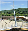
Supporting tower, Calzaghe bridge, Newbridge
Looking towards Newbridge Comprehensive School, and part of the £3.2 million footbridge opened in September 2009. Named after the town’s unbeaten world boxing champion Joe Calzaghe, the bridge is a key part of the Newbridge Regeneration Programme. It provides an important link for pedestrians and cyclists, including full disabled access, between Newbridge town centre, Newbridge Comprehensive School, the nearby leisure centre and the railway station.
The project has been funded through a combination of grants from the Welsh Assembly Government, the European Regional Development Fund, Caerphilly County Borough Council and Newbridge Community Partnership.
The bridge is actually two connected footway/cycleway bridges - one spanning the Ebbw Valley railway and the other the Ebbw River.
Image: © Jaggery
Taken: 23 Jun 2010
0.02 miles
9
Recently added piles of lineside ballast near Newbridge railway station
Viewed in September 2015 when work on doubling the track between Crosskeys Junction and Aberbeeg Junction has begun. When complete, the double track will enable a more frequent service on the Ebbw Vale line, currently a maximum of one train per hour in each direction.
Behind the camera, some track support sleepers are already in place. http://www.geograph.org.uk/photo/4665646
Image: © Jaggery
Taken: 18 Sep 2015
0.02 miles
10
Railway footbridge, Newbridge
Part of the Calzaghe Bridge http://www.geograph.org.uk/photo/1927197 viewed from Newbridge railway station.
Image: © Jaggery
Taken: 9 Jan 2014
0.03 miles


