1
Small lake, Jubilee Park, Rogerstone (4)
Redevelopment of the site of the former Alcan Works commenced in 2013.
This small lake was created near to the entrance to this large estate.
Image: © Robin Drayton
Taken: 22 Oct 2021
0.02 miles
2
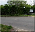
ILDIWCH/GIVE WAY sign facing Tregwilym Road, Rogerstone, Newport
The Welsh/English sign is at the Jubilee Way junction opposite Mandrake House flats.
Image: © Jaggery
Taken: 20 Apr 2017
0.02 miles
3
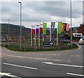
Welcome to Jubilee Park, Rogerstone, Newport
On the corner of Tregwilym Road and Jubilee Way at the entrance to recently-built houses on the former Alcan site, viewed in April 2017. Names on the flags are Taylor Wimpey, Barratt, Bellway.
Image: © Jaggery
Taken: 20 Apr 2017
0.03 miles
4
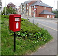
Queen Elizabeth II postbox on a Rogerstone corner, Newport
Alongside Tregwilym Road near Tregwilym Lodge http://www.geograph.org.uk/photo/5358578 behind the camera.
Image: © Jaggery
Taken: 20 Apr 2017
0.03 miles
5
Pathside telecoms cabinets, Rogerstone, Newport
Two dark green cabinets are alongside this http://www.geograph.org.uk/photo/5358590 path.
Image: © Jaggery
Taken: 20 Apr 2017
0.03 miles
6
Modern flats, Tregwilym Road, Rogerstone
This is the southern loop of Tregwilym Road, which leads to Tregwilym Industrial Estate. This view, heading away from the Industrial Estate, is of modern brick-built flats. In contrast, to the right of the flats is a terrace of stone-built houses. http://www.geograph.org.uk/photo/1608298
Image: © Jaggery
Taken: 12 Oct 2009
0.04 miles
7
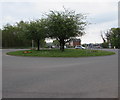
Trees on a Rogerstone roundabout, Newport
The roundabout is in the middle of the B4591.
Image: © Jaggery
Taken: 20 Apr 2017
0.04 miles
8
Tregwilym Lodge, Rogerstone, Newport
Nursing & residential care home viewed across Tregwilym Road.
Image: © Jaggery
Taken: 20 Apr 2017
0.04 miles
9
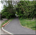
Path north from Tregwilym Road, Rogerstone, Newport
Towards the B4591.
Image: © Jaggery
Taken: 20 Apr 2017
0.05 miles
10
Direction sign 19 miles from Brynmawr and 3 miles from Risca
The sign is alongside this http://www.geograph.org.uk/photo/5358594 entrance slip road to the A467 northbound in Rogerstone, Newport.
Image: © Jaggery
Taken: 20 Apr 2017
0.05 miles


