1
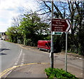
Scholars Close, Rogerstone
Recently-built houses viewed across Tregwilym Road in May 2018.
Image: © Jaggery
Taken: 1 May 2018
0.01 miles
2
Former school, Rogerstone
Now commercial premises.
Image: © John Lord
Taken: 5 May 2012
0.01 miles
3
Dudley's Tydu Works, Tregwilym Road, Rogerstone
256-260 Tregwilym Road. S Dudley & Sons Ltd are contractors specialising in
construction, shopfitting and bespoke architectural aluminium facade products.
The buildings were formerly the Rogerstone and Henllis School Board School.
Henllis is now spelt Henllys. The Rogerstone and Henllis School Board was
established in 1874 under the terms of the Elementary Education Act 1870. School Boards were elected bodies, empowered to levy rates and to set up and maintain schools in areas where voluntary provision was inadequate.
The school was built in 1877 and enlarged in 1889. Its capacity was 600 children. A report in 1953 stated that the school buildings and site were ‘very defective’ and that ‘modern accommodation was necessary.’, but it was not until 1976 that a new school elsewhere in Rogerstone allowed the old school to close.
Image: © Jaggery
Taken: 12 Oct 2009
0.01 miles
4
Recently-built houses, Tregwilym Road, Rogerstone
Viewed in May 2018. The corner of Scholars Close https://www.geograph.org.uk/photo/5759707 is on the right.
Image: © Jaggery
Taken: 1 May 2018
0.03 miles
5
Houses in Tregwilym Rd, Rogerstone
Image: © John Lord
Taken: 5 May 2012
0.05 miles
6
Dead-end side road in Rogerstone
On the southeast side of St John's Crescent.
Image: © Jaggery
Taken: 1 May 2018
0.05 miles
7
Brown and green direction signs, Tregwilym Road, Rogerstone
The brown sign points the way to Rogerstone welfare grounds. The text is also in Welsh.
The small green signs show Sirhowy Valley Walk.
Image: © Jaggery
Taken: 1 May 2018
0.05 miles
8
Edge of Wern Industrial Estate, Rogerstone
Viewed from the Tregwilym Road bridge above the A467.
Image: © Jaggery
Taken: 4 Mar 2011
0.05 miles
9
A467 at Rogerstone
Image: © Colin Pyle
Taken: 2 Jan 2012
0.07 miles
10
A467, Rogerstone, Newport
Viewed from Chartist Drive bridge looking NW.
Image: © Jaggery
Taken: 14 Nov 2013
0.07 miles


