1
Alongside the river [2]
The footpath continues to pass along the bank of the Ebbw River. This view is looking north west.
Image: © Michael Dibb
Taken: 10 Mar 2010
0.04 miles
2
Risca Road Rogerstone approaching the turning for Rivermead Way
The turning for Rivermead Way, and Rogerstone railway station, is a little ahead, on the left.
Image: © Jaggery
Taken: 26 Feb 2010
0.07 miles
3
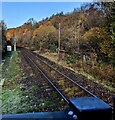
The view northwestwards from Rogerstone railway station
The next stop in this direction is at Risca & Pontymister station.
Rogerstone station opened for passenger service on February 6th 2008.
Image: © Jaggery
Taken: 26 Feb 2010
0.10 miles
4
Houses on Risca Road, Rogerstone
Houses on the north side of Risca Road.
A short distance ahead is the turning for Rivermead Way, which leads to Rogerstone railway station.
Image: © Jaggery
Taken: 26 Feb 2010
0.10 miles
5
River bridge [1]
A well maintained footbridge over the Ebbw River. The bridge connects Cedar Wood Drive on the east bank with Jasmine Close on the west bank.
Image: © Michael Dibb
Taken: 10 Mar 2010
0.11 miles
6
Bungalows on Risca Road, Rogerstone
Bungalows on the north side of Risca Road.
A short distance ahead is the turning for Rivermead Way, which leads to Rogerstone railway station
Image: © Jaggery
Taken: 26 Feb 2010
0.11 miles
7
River bridge [3]
The bridge carrying Rivermead Way over the Ebbw River did not allow the footpath to continue on the bank. Walkers are required to ascend to the road to cross it and then to descend to the river bank again. This view is from Rivermead Way looking towards the recently re-built Rogerstone railway station.
Image: © Michael Dibb
Taken: 10 Mar 2010
0.12 miles
8
River bridge [2]
This modern bridge carries Rivermead Way over the Ebbw River.
Image: © Michael Dibb
Taken: 10 Mar 2010
0.12 miles
9
Children's play area, Rogerstone
The large housing development in this area is on the site of the former Rogerstone power station.
Image: © Robin Drayton
Taken: 31 Aug 2007
0.14 miles
10
Single-track railway NW of Rogerstone station, Newport
Next station ahead is Risca & Pontymister.
Image: © Jaggery
Taken: 8 Dec 2022
0.14 miles


![Alongside the river [2]](https://s0.geograph.org.uk/geophotos/01/81/45/1814572_a853bbf6_120x120.jpg)


![River bridge [1]](https://s0.geograph.org.uk/geophotos/01/81/45/1814568_d5d831fe_120x120.jpg)

![River bridge [3]](https://s0.geograph.org.uk/geophotos/01/81/45/1814584_4ca456c2_120x120.jpg)
![River bridge [2]](https://s2.geograph.org.uk/geophotos/01/81/45/1814578_24abbf91_120x120.jpg)

