IMAGES TAKEN NEAR TO
Bassaleg, NEWPORT, NP10 8RW
Introduction
This page details the photographs taken nearby to NP10 8RW by members of the Geograph project.
The Geograph project started in 2005 with the aim of publishing, organising and preserving representative images for every square kilometre of Great Britain, Ireland and the Isle of Man.

There are currently over 7.5m images from over14,400 individuals and you can help contribute to the project by visiting https://www.geograph.org.uk
Image Map
Images are licensed for reuse under creativecommons.org/licenses/by-sa/2.0
Notes
- Clicking on the map will re-center to the selected point.
- The higher the marker number, the further away the image location is from the centre of the postcode.
Image Listing (8 Images Found)
Images are licensed for reuse under creativecommons.org/licenses/by-sa/2.0
Image
Details
Distance
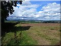
1
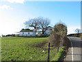
Patriotic Cottage
On the highest point of Pen-y-lan Hill
Image: © John Thorn
Taken: 26 Feb 2007
0.03 miles
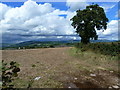
2
Field and tree shadow, near Pen-y-lan
Image: © Ruth Sharville
Taken: 7 Sep 2010
0.03 miles
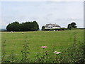
4
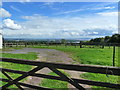
Gates, a field, and a stunning view
The estuary of the River Severn can be seen in the far distance.
Image: © Ruth Sharville
Taken: 7 Sep 2010
0.05 miles