1
Pedestrian Zone sign, Tredegar Street, Rhiwderin
Located near the southern end of dead-end Tredegar Street,
the sign shows No vehicles Except for emergency services.
Image: © Jaggery
Taken: 17 Apr 2019
0.01 miles
2
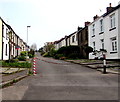
Down Tredegar Street, Rhiwderin
Tredegar Street descends towards Pentre Tai Road.
Image: © Jaggery
Taken: 17 Apr 2019
0.01 miles
3
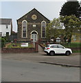
Victorian Tabernacle Congregational Chapel in Rhiwderin
Tabernacle Congregational Chapel is dated 1884. https://www.geograph.org.uk/photo/6123036
In April 2019 this is one of two places of worship in Rhiwderin.
The other one is Rhiwderin Free Presbyterian Church https://www.geograph.org.uk/photo/6123098
Image: © Jaggery
Taken: 17 Apr 2019
0.01 miles
4
1884 tablet on Tabernacle Congregational Chapel, Rhiwderin
On the wall here. https://www.geograph.org.uk/photo/6123027
Image: © Jaggery
Taken: 17 Apr 2019
0.01 miles
5
Chain across Tredegar Street, Rhiwderin
A Pedestrian Zone sign https://www.geograph.org.uk/photo/6128725 is near the camera.
Image: © Jaggery
Taken: 17 Apr 2019
0.01 miles
6
Tabernacle Congregational Chapel information board, Rhiwderin
Located behind the car here. https://www.geograph.org.uk/photo/6123027
In April 2019 the board shows that Sunday Services begin at 11am and 6pm.
Weekly secular uses of the chapel include the Friday Computer Group from 2:30pm.
Image: © Jaggery
Taken: 17 Apr 2019
0.02 miles
7
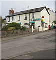
Rhiwderin Post Office and shop
At the southern end of Tredegar Street near the Pentre Tai Road junction viewed in April 2019.
Image: © Jaggery
Taken: 17 Apr 2019
0.02 miles
8
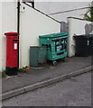
Queen Elizabeth II pillarbox, Tredegar Street, Rhiwderin
Located on the right here https://www.geograph.org.uk/photo/6130728 outside the village post office.
Image: © Jaggery
Taken: 17 Apr 2019
0.02 miles
9
Dominant conifer, Tabernacle Drive, Rhiwderin
Viewed from Harlech Drive in April 2019.
Image: © Jaggery
Taken: 17 Apr 2019
0.02 miles
10
Tabernacle Congregational Chapel, Rhiwderin
Image: © John Lord
Taken: 12 Jan 2012
0.03 miles


