1
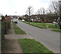
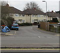
Church Crescent houses, Bassaleg
Houses on the NE side of Church Crescent, NW of Ruperra Close.
Image: © Jaggery
Taken: 27 Oct 2012
0.03 miles
2
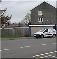
Church Crescent semis, Bassaleg
Semi-detached houses on the north side of Church Crescent.
Image: © Jaggery
Taken: 19 Mar 2019
0.04 miles
3
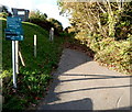
Path to a Nature Conservation Area, Bassaleg
The path ascends from the north side of Church Crescent towards an area
on the south bank of the River Ebbw that includes Garth Wood.
A Newport City Council notice states that this is a designated area
under the Dogs (Fouling of Land) Act 1996. It is an offence NOT
to clean up after your dog. Maximum penalty £1000.
Image: © Jaggery
Taken: 27 Oct 2012
0.04 miles
4
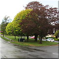
Up Laurel Road, Bassaleg
Laurel Road ascends away from the camera near the corner of St Basil's Crescent.
Image: © Jaggery
Taken: 19 Mar 2019
0.06 miles
5
Laurel Road bus stop and shelter, Bassaleg
This stop is for buses to Market Square bus station in Newport.
Image: © Jaggery
Taken: 19 Mar 2019
0.06 miles
6
Bus stop and shelter under trees, Laurel Road, Bassaleg
This photo taken on April 25th 2019 contrasts with a leafless view https://www.geograph.org.uk/photo/6091187 on March 19th 2019.
Image: © Jaggery
Taken: 25 Apr 2019
0.06 miles
7
Laurel Rd, eastern end, Bassaleg
Image: © John Lord
Taken: 12 Jan 2012
0.06 miles
8
St Basil's Crescent electricity substation, Bassaleg
Western Power Distribution electricity substation on the corner of St Basil's Crescent and Laurel Road.
The substation identifier is ST BASILS CRES. BASSALEG S/S 531180
Image: © Jaggery
Taken: 19 Mar 2019
0.08 miles
9
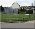
Junction of Ruperra Close and Church Crescent, Bassaleg
The western end of Ruperra Close viewed across Church Crescent.
Image: © Jaggery
Taken: 19 Mar 2019
0.09 miles
10
Machen Pharmacy van parked in Laurel Road, Bassaleg
The van is based at 36 Commercial Road in Machen. https://www.geograph.org.uk/photo/6087274
Image: © Jaggery
Taken: 19 Mar 2019
0.09 miles


