1
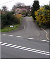
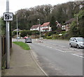
Up Highfield Lane, Bassaleg
From the north side of the A468 Caerphilly Road,
Highfield Lane ascends towards Highfield Gardens.
Image: © Jaggery
Taken: 20 Mar 2019
0.03 miles
2
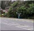
Bus stop and shelter on the north side of Caerphilly Road, Bassaleg
This stop on Stagecoach route 50 is for buses to Newport.
Image: © Jaggery
Taken: 20 Mar 2019
0.03 miles
3
Pedestrian refuge, Caerphilly Road, Bassaleg
In the middle of the A468.
Image: © Jaggery
Taken: 20 Mar 2019
0.03 miles
4
Garth Hill Water Trough, Bassaleg
Located next to a Caerphilly Road bus stop, near the corner of Highfield Lane.
A plaque states that the trough is fed by Ffynnon Basil. It was restored in 2003 by Graig Best Kept Villages Group.
Image: © Jaggery
Taken: 5 Mar 2011
0.05 miles
5
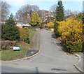
Highfield Lane, Bassaleg
Highfield Lane (leading to Highfield Gardens) climbs steeply away from the north side of Caerphilly Road (A468).
Image: © Jaggery
Taken: 5 Mar 2011
0.05 miles
6
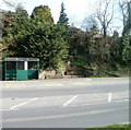
Bus shelter and restored trough, Caerphilly Road, Bassaleg
On the right side of the shelter is a restored trough. http://www.geograph.org.uk/photo/2771232
Image: © Jaggery
Taken: 5 Mar 2011
0.05 miles
7
Speed camera warning sign alongside Caerphilly Road, Bassaleg
Alongside the A468 Caerphilly Road.
Image: © Jaggery
Taken: 20 Mar 2019
0.05 miles
8
Queen Elizabeth II postbox and Royal Mail drop box alongside Caerphilly Road, Bassaleg
Image: © Jaggery
Taken: 20 Mar 2019
0.05 miles
9
Caerphilly Road pedestrian refuge in Bassaleg
In the middle of the A468 Caerphilly Road.
Image: © Jaggery
Taken: 20 Mar 2019
0.05 miles
10
Northern end of Ffos-y-fran, Bassaleg
Looking south from the corner of Caerphilly Road. Welsh for Crow's Ditch, Ffos-y-fran leads to Ffos-y-fran Close. Ffos is one of a small number of Welsh words derived from Latin, in this case, fossa, a ditch. Fran is a mutated form of bran, a crow. In Welsh, the correct spellings are brân and frân. The circumflex accent distinguishes brân (crow) from bran (bran).
Image: © Jaggery
Taken: 20 Mar 2019
0.05 miles


