1
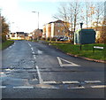
Morgan Way pavement and grass verge, Newport
Looking east towards Lighthouse Road.
Image: © Jaggery
Taken: 10 Nov 2012
0.01 miles
2
Reen tunnel, Lighthouse Road, Newport
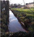
A reen (drainage channel) on the west side of Lighthouse Road, enters a tunnel to pass under Morgan Way.
Image: © Jaggery
Taken: 21 Jan 2010
0.02 miles
3
Schooner Walk, Newport
Houses on Schooner Walk viewed from Lighthouse Road. Access to the houses is from Morgan Way.
Image: © Jaggery
Taken: 21 Jan 2010
0.02 miles
4
Schooner Avenue houses, Newport
Viewed from Morgan Way, near the junction with Lighthouse Road. The houses were built c2007.
Image: © Jaggery
Taken: 25 Dec 2013
0.02 miles
5
Reen towards Morgan Way, Newport
Viewed from the footbridge seen here. http://www.geograph.org.uk/photo/3837724
The reen is part of an extensive network of channels draining the Wentlooge Level.
Image: © Jaggery
Taken: 25 Dec 2013
0.03 miles
6
Manor Park switching site, Newport
On the corner of Morgan Way and Lighthouse Road. The identifier on the Western Power Distribution electricity substation is MANOR PARK SWITCHING SITE S/S No. 53-7001.
Image: © Jaggery
Taken: 25 Dec 2013
0.03 miles
7
Eastern end of Morgan Way, Newport
Viewed from Lighthouse Road.
Image: © Jaggery
Taken: 10 Nov 2012
0.04 miles
8
Lighthouse Road (B4239)
Towards Newport.
Image: © JThomas
Taken: 15 Oct 2019
0.04 miles
9
Junction of Lighthouse Road and Morgan Way, Newport
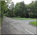
From the right, Morgan Way joins Lighthouse Road.
Ahead on the B4239 Lighthouse Road for St Brides.
Image: © Jaggery
Taken: 13 Aug 2020
0.04 miles
10
Start of the 30mph zone, Lighthouse Road, Newport
The 50mph speed limit behind the camera reduces to 30mph near the left turn ahead for Morgan Way.
Image: © Jaggery
Taken: 25 Apr 2013
0.04 miles


