1
The Boulevards
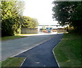
This picture from 2010 shows this location as the entrance to a factory.
Image
That has obviously gone and it's now new housing.
Image: © Des Blenkinsopp
Taken: 8 May 2016
0.02 miles
2
Entrance to Panasonic factory, Newport
The entrance drive and pavement is from Pencarn Way roundabout.
Image: © Jaggery
Taken: 25 Sep 2010
0.13 miles
3
St Joseph's RC High School, Duffryn
Located adjacent to the Asda superstore. http://www.geograph.org.uk/photo/1673287
Image: © Jaggery
Taken: 21 Jan 2010
0.15 miles
4
Asda filling station, Duffryn
Located at the southwest edge of Asda's superstore site. http://www.geograph.org.uk/photo/1673287
Image: © Jaggery
Taken: 21 Jan 2010
0.16 miles
5
Sir Briggs Avenue
This road on an industrial estate is named after the warhorse of the first Viscount Tredegar. Sir Briggs was ridden in the battles of the Crimean War
Image: © David Smith
Taken: 4 Jun 2018
0.16 miles
6
Eastern section of Pencarn Lane, Coedkernew
Pencarn Lane heads away from the east side of Imperial Way. The western section of Pencarn Lane http://www.geograph.org.uk/photo/2082206 is about 30 metres further along Imperial Way.
Image: © Jaggery
Taken: 25 Sep 2010
0.16 miles
7
Roundabout on Pencarn Way
The sign advertises Imperial Park a business/industrial estate
Image: © David Smith
Taken: 4 Jun 2018
0.17 miles
8
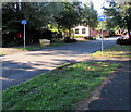
Cycle route signs, Morgraig Avenue, Newport
A small label on the sign pole on the left shows that this route is part of National Cycle Network Route 88, a mainly coastal route from Newport to Margam Country Park via Cardiff and Bridgend. In August 2018, only short sections of the route are open.
Image: © Jaggery
Taken: 13 Aug 2018
0.18 miles
9
Ryder Cup 2010 park and ride notices, Imperial Way, Coedkernew
Late September 2010 : notices on Imperial Way point in the direction of park and ride facilities for those attending the 2010 Ryder Cup, which begins at Celtic Manor on the eastern side of the city of Newport on October 1, 2010.
Image: © Jaggery
Taken: 25 Sep 2010
0.18 miles
10
Imperial Park, Newport
Surface Technology Systems
Image: © Kev Griffin
Taken: 16 Nov 2004
0.18 miles


