1
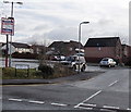
Stevenson Close, Rogerstone, Newport
Viewed from the corner of Ruskin Avenue in the Mount Pleasant area of Rogerstone.
Image: © Jaggery
Taken: 23 Jan 2014
0.02 miles
2
Tree-lined school entrance gates, Rogerstone, Newport
Viewed across Ruskin Avenue towards Mount Pleasant Primary School in January 2014.
On Thursday September 4th 2014, the school featured in the world media and on the front page of the White House website after it was briefly visited by US President Barack Obama, along with British Prime Minister David Cameron. Later that day, both men went to the NATO summit being held at the Celtic Manor a few kilometres to the east. The visit was the result of a letter sent to the White House and an appeal on Twitter sent by the Deputy Headmaster.
Image: © Jaggery
Taken: 23 Jan 2014
0.05 miles
3
Ruskin Avenue houses, Rogerstone, Newport
Ruskin Avenue is the main road through the Mount Pleasant area of Rogerstone.
This view is towards the Stevenson Close junction, out of shot ahead.
Image: © Jaggery
Taken: 23 Jan 2014
0.06 miles
4
Houses between Scott Walk and Stevenson Close, Rogerstone, Newport
Viewed across Ruskin Avenue. Scott Walk is on the left.
Image: © Jaggery
Taken: 23 Jan 2014
0.07 miles
5
The Olde Oak Inn, Rogerstone, Newport
Pub and restaurant (Squires Bar and The Fourteen Locks Restaurant) in the Mount Pleasant area of Rogerstone, on the corner of Ruskin Avenue and Squires Gate.
Image: © Jaggery
Taken: 23 Jan 2014
0.08 miles
6
Scott Walk, Rogerstone, Newport
Viewed across Ruskin Avenue in the Mount Pleasant area of Rogerstone.
Image: © Jaggery
Taken: 23 Jan 2014
0.09 miles
7
West side of Hunter Close, Rogerstone, Newport
Viewed from Ruskin Avenue, the main road through the Mount Pleasant area of Rogerstone.
Image: © Jaggery
Taken: 23 Jan 2014
0.10 miles
8
Donation bins, Squires Gate, Rogerstone, Newport
Located at the Squires Gate end of The Olde Oak Inn http://www.geograph.org.uk/photo/3908928 car park. The two red bins, a books & music bank and a clothing bank, are for donations to the British Heart Foundation.
Image: © Jaggery
Taken: 23 Jan 2014
0.11 miles
9
Western end of Squires Gate, Rogerstone, Newport
Viewed across Ruskin Avenue. The street name sign shows Squires Gate leading to Squires Close.
Image: © Jaggery
Taken: 23 Jan 2014
0.11 miles
10
End of the 20 zone, Ruskin Avenue, Rogerstone, Newport
The 20mph maximum speed limit near a school increases to 30mph ahead.
Image: © Jaggery
Taken: 23 Jan 2014
0.12 miles


