1
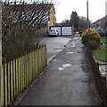
Ruskin Avenue passes Delius Close, Rogerstone, Newport
Delius Close http://www.geograph.org.uk/photo/3823899 is on the left. Paxton Walk http://www.geograph.org.uk/photo/3823868 is ahead on the right.
Image: © Jaggery
Taken: 23 Jan 2014
0.01 miles
2
Delius Close, Rogerstone, Newport
Viewed across Ruskin Avenue looking towards Waterside Walk West.
Image: © Jaggery
Taken: 23 Jan 2014
0.02 miles
3
Gnomes in a canalside garden, Rogerstone
Image: © David Smith
Taken: 25 Sep 2021
0.03 miles
4
Waterside Walk West, Rogerstone, Newport
Viewed from the corner of Delius Close. The waterside in question is the disused Crumlin Arm of the Monmouthshire & Brecon Canal, behind the houses on the right side of the path.
Image: © Jaggery
Taken: 23 Jan 2014
0.03 miles
5
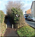
No cars or motorbikes ahead, Groes Road, Rogerstone, Newport
It seems that this narrow path, shown as Groes Road on some maps, is a right of way existing from before the modern houses surrounding it were built. The sign shows no cars or motorbikes, but the function of the concrete posts is unclear. The gap is wide enough for a motorbike to pass through.
The way ahead looks to be too narrow for a car. Paxton Walk is on the right. http://www.geograph.org.uk/photo/3823868
Image: © Jaggery
Taken: 23 Jan 2014
0.03 miles
6
Groes Road canal bridge
Groes Road was closed off in the 1970s when a nearby housing estate was constructed.
Image: © Robin Drayton
Taken: 1 Feb 2008
0.04 miles
7
Canal-side houses
These houses have excellent views as well as a lovely water feature at the bottom of their gardens.
Image: © Michael Dibb
Taken: 10 Mar 2010
0.04 miles
8
Groes Road canal bridge, Rogerstone, Newport
The bridge carries Groes Road over the disused Monmouthshire and Brecon canal (Crumlin Arm).
Built in the 1790s, the hump-backed bridge was Grade II listed in 2003. Groes Road, formerly a through road for motor vehicles, is now a footpath and cycle route, part of National Cycle Network route 47.
Image: © Jaggery
Taken: 23 Jan 2014
0.04 miles
9
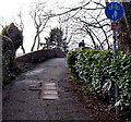
Groes Road approaches a canal bridge, Rogerstone, Newport
Formerly a through road for motor vehicles, Groes Road is now a footpath and cycle route,
part of National Cycle Network route 47. Ahead, it crosses this http://www.geograph.org.uk/photo/3972753 bridge.
Image: © Jaggery
Taken: 23 Jan 2014
0.04 miles
10
Bridge over the Monmouthshire-Brecon Canal, Rogerstone
The bridge links Groes Road with Delius Close. The canal here is only fit for use by wildfowl.
Image: © Ruth Sharville
Taken: 25 Oct 2021
0.04 miles


