
IMAGES TAKEN NEAR TO
Milner Road, WELLINGBOROUGH, NN9 5LW
Introduction
This page details the photographs taken nearby to Milner Road, NN9 5LW by members of the Geograph project.
The Geograph project started in 2005 with the aim of publishing, organising and preserving representative images for every square kilometre of Great Britain, Ireland and the Isle of Man.

There are currently over 7.5m images from over14,400 individuals and you can help contribute to the project by visiting https://www.geograph.org.uk
Image Map
Images are licensed for reuse under creativecommons.org/licenses/by-sa/2.0
Notes
- Clicking on the map will re-center to the selected point.
- The higher the marker number, the further away the image location is from the centre of the postcode.
Image Listing (6 Images Found)
Images are licensed for reuse under creativecommons.org/licenses/by-sa/2.0
Image
Details
Distance
1
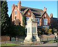
Finedon War Memorial
The memorial stands beside the A510 Wellingborough Road
Image: © Will Lovell
Taken: 9 Feb 2006
0.13 miles
2
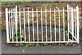
Boundary Stone
Stone in Dolben Square with a plaque.
"This Ancient Stone
is thought to have been placed here
in Prehistoric Times
as a boundary marker of some kind
Nearby, a public water supply pump stood for many years to serve the people of Finedon.
Finedon Local History Society 2018"
Image: © Richard Croft
Taken: 10 Aug 2023
0.20 miles
3
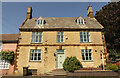
55 High Street, Finedon
Handsome Grade II listed, early 18th century house on High Street in Finedon
Image: © Richard Croft
Taken: 10 Aug 2023
0.21 miles
4
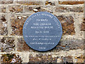
Plaque on the wall of Finedon Friends' Meeting House
Image: © John Lucas
Taken: 25 Nov 2013
0.21 miles
5
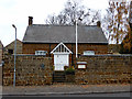
Finedon Friends' Meeting House
Now the home of Finedon Local History Society: http://www.newfinedon.utvinternet.com/finedon_local_history_society.htm
Image: © John Lucas
Taken: 25 Nov 2013
0.21 miles
6
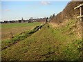
Footpath to Finedon
Finedon Church spire can be seen over the houses
Image: © Will Lovell
Taken: 9 Feb 2006
0.24 miles