IMAGES TAKEN NEAR TO
Rookery View, WELLINGBOROUGH, NN9 5DA
Introduction
This page details the photographs taken nearby to Rookery View, NN9 5DA by members of the Geograph project.
The Geograph project started in 2005 with the aim of publishing, organising and preserving representative images for every square kilometre of Great Britain, Ireland and the Isle of Man.

There are currently over 7.5m images from over14,400 individuals and you can help contribute to the project by visiting https://www.geograph.org.uk
Image Map
Images are licensed for reuse under creativecommons.org/licenses/by-sa/2.0
Notes
- Clicking on the map will re-center to the selected point.
- The higher the marker number, the further away the image location is from the centre of the postcode.
Image Listing (11 Images Found)
Images are licensed for reuse under creativecommons.org/licenses/by-sa/2.0
Image
Details
Distance
8
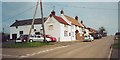
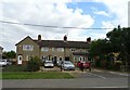
The Lamb PH, Little Harrowden, Northants.
The Lamb PH. Formerly my 'local' but now just a happy memory.
Image: © Gary Sutherland
Taken: 16 Apr 2000
0.13 miles
9
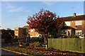
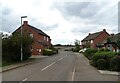
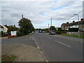
Houses on Orlingbury Road, Little Harrowden
Image: © David Howard
Taken: 30 Oct 2022
0.17 miles