
IMAGES TAKEN NEAR TO
Church Street, WELLINGBOROUGH, NN8 4PA
Introduction
This page details the photographs taken nearby to Church Street, NN8 4PA by members of the Geograph project.
The Geograph project started in 2005 with the aim of publishing, organising and preserving representative images for every square kilometre of Great Britain, Ireland and the Isle of Man.

There are currently over 7.5m images from over14,400 individuals and you can help contribute to the project by visiting https://www.geograph.org.uk
Image Map
Images are licensed for reuse under creativecommons.org/licenses/by-sa/2.0
Notes
- Clicking on the map will re-center to the selected point.
- The higher the marker number, the further away the image location is from the centre of the postcode.
Image Listing (92 Images Found)
Images are licensed for reuse under creativecommons.org/licenses/by-sa/2.0
Image
Details
Distance
1
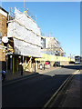
Tresham Institute of Further & Higher Education, Church Street
Planning permission has been granted, with conditions, by Wellingborough Borough Council under application number WP/2013/0605 for the “development of a 3 storey building for educational use with associated infrastructure and landscaping to include demolition of existing”.
Image: © John Baker
Taken: 15 Feb 2019
0.02 miles
2
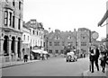
Wellingborough, 1957: eastward on A5193 Sheep Street
As things were nearly 60 years ago.
Image: © Ben Brooksbank
Taken: 14 Sep 1957
0.02 miles
3
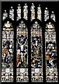
Wellingborough, All Hallows Church: Stained glass window
Image: © Michael Garlick
Taken: 27 Mar 2024
0.03 miles
4
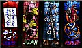
Wellingborough, All Hallows Church: Window by Patrick Reyntiens and John Piper 2
Image: © Michael Garlick
Taken: 27 Mar 2024
0.03 miles
5
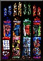
Wellingborough, All Hallows Church: Window by Patrick Reyntiens and John Piper 1
Image: © Michael Garlick
Taken: 27 Mar 2024
0.03 miles
6
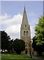
All Hallows Church Steeple
The iron-stone structure is about 600 years old. Nothing remains of the original Saxon church which was administered by the monks of Croyland Abbey.
Image: © Kokai
Taken: 6 Jun 2006
0.03 miles
7
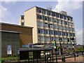
Tresham Institute of Further and Higher Education
The main campus is in Kettering. As an associate college of De Montfort University, the Institute can offer some Degree courses as well as Diplomas, Certificates, IT and leisure courses. One of the shelters of Wellingborough Bus Station can be seen in the foreground.
Image: © Kokai
Taken: 6 Jun 2006
0.03 miles

9
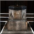
Wellingborough, All Hallows Church: The font
Image: © Michael Garlick
Taken: 27 Mar 2024
0.03 miles
10
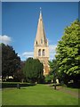
Wellingborough: Church of All Hallows
This is the west tower of the Grade I Listed church. The tower was built in the late 13th century of 3 stages, where the lower 2 are banded limestone and ironstone and the upper stage is ashlar. The broach spire is of ashlar with octagonal corner pinnacles and 2 tiers of lucarnes.
Interestingly old large scale Ordnance Survey maps up to and including the edition of 1900 show the church as St Luke's, not All Hallows.
Image: © Nigel Cox
Taken: 14 Jun 2019
0.03 miles