
IMAGES TAKEN NEAR TO
Doddington Road, WELLINGBOROUGH, NN8 2UA
Introduction
This page details the photographs taken nearby to Doddington Road, NN8 2UA by members of the Geograph project.
The Geograph project started in 2005 with the aim of publishing, organising and preserving representative images for every square kilometre of Great Britain, Ireland and the Isle of Man.

There are currently over 7.5m images from over14,400 individuals and you can help contribute to the project by visiting https://www.geograph.org.uk
Image Map
Images are licensed for reuse under creativecommons.org/licenses/by-sa/2.0
Notes
- Clicking on the map will re-center to the selected point.
- The higher the marker number, the further away the image location is from the centre of the postcode.
Image Listing (5 Images Found)
Images are licensed for reuse under creativecommons.org/licenses/by-sa/2.0
Image
Details
Distance
1
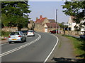
Main Road, Wilby
Junction of the A4500 and Doddington Road taken from the 'A' road.
Image: © Kokai
Taken: 17 Aug 2005
0.16 miles
3
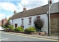
The Manor House, Wilby
The building on the right looks like a long barn; it has a central broad arched doorway.
Image: © Humphrey Bolton
Taken: 25 Aug 2011
0.18 miles
5
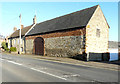
Manor House, Main Road
It is a grade II listed manor house, which dates from the mid 18th century
https://britishlistedbuildings.co.uk/101040684-manor-house-wilby#.XIAWlf43bcc
The adjoining barn is also grade II listed. It dates from the mid 18th century but was altered in the 19th century https://historicengland.org.uk/listing/the-list/list-entry/1286795
This picture of Image shows the house, when its exterior walls were rendered and painted.
Image: © John Baker
Taken: 15 Feb 2019
0.24 miles