
IMAGES TAKEN NEAR TO
Mill Road, WELLINGBOROUGH, NN8 1QT
Introduction
This page details the photographs taken nearby to Mill Road, NN8 1QT by members of the Geograph project.
The Geograph project started in 2005 with the aim of publishing, organising and preserving representative images for every square kilometre of Great Britain, Ireland and the Isle of Man.

There are currently over 7.5m images from over14,400 individuals and you can help contribute to the project by visiting https://www.geograph.org.uk
Image Map
Images are licensed for reuse under creativecommons.org/licenses/by-sa/2.0
Notes
- Clicking on the map will re-center to the selected point.
- The higher the marker number, the further away the image location is from the centre of the postcode.
Image Listing (50 Images Found)
Images are licensed for reuse under creativecommons.org/licenses/by-sa/2.0
Image
Details
Distance
1
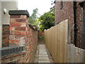
Alleyway off Mill Road, Wellingborough
Image: © Richard Vince
Taken: 7 May 2022
0.02 miles
2
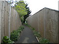
Footpath to Mill Road, Wellingborough
From Midland Road.
Image: © Richard Vince
Taken: 7 May 2022
0.08 miles
3
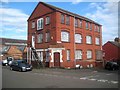
Wellingborough: Former shoe factory
This area of Wellingborough is littered with scattered odd buildings that reflect the town's industrial past. This former shoe factory, at the junction of Melton Road with Mill Road, dates from 1898 and is aptly now called Cobblers Loft.
Image: © Nigel Cox
Taken: 14 Jun 2019
0.09 miles
4
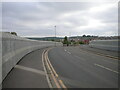
Driver Way, Wellingborough
Crossing the railway line north of Wellingborough station (hence the parapets).
Image: © Richard Vince
Taken: 7 May 2022
0.11 miles
5
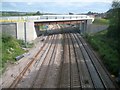
Wellingborough: New Stanton Cross development bridge over railway
The Stanton Cross urban extension project on the east side of the railway at Wellingborough will eventually provide about 3,650 new homes and about 3,000 new jobs, according to the South East Midlands Local Enterprise Project (SEMLEP). This is the new access bridge to the development, over the Midland Main Line railway just to the north of Wellingborough station, as viewed from the existing Mill Lane bridge.
Image: © Nigel Cox
Taken: 14 Jun 2019
0.11 miles
6
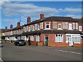
Wellingborough: Mill Road
This Edwardian terrace on Mill Road is typical of the housing in this area of Wellingborough.
Image: © Nigel Cox
Taken: 14 Jun 2019
0.13 miles
8
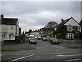
Leys Road, Wellingborough
Off Eastfield Road.
Image: © Richard Vince
Taken: 7 May 2022
0.15 miles
9
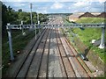
Midland Main Line railway north of Wellingborough
Extensive gantry works have recently been made on the line to convert it to overhead electrical power, although the cabling is not yet in place. The track was originally opened through here by the Midland Railway in 1857. This is the view from the Mill Lane bridge.
Image: © Nigel Cox
Taken: 14 Jun 2019
0.16 miles
10
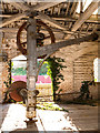
Wellingborough station - April 2018 (2)
An old crane in the disused Wellingborough goods store.
Image: © The Carlisle Kid
Taken: 20 Apr 2018
0.16 miles