
IMAGES TAKEN NEAR TO
Martyns Way, NORTHAMPTON, NN7 4RS
Introduction
This page details the photographs taken nearby to Martyns Way, NN7 4RS by members of the Geograph project.
The Geograph project started in 2005 with the aim of publishing, organising and preserving representative images for every square kilometre of Great Britain, Ireland and the Isle of Man.

There are currently over 7.5m images from over14,400 individuals and you can help contribute to the project by visiting https://www.geograph.org.uk
Image Map
Images are licensed for reuse under creativecommons.org/licenses/by-sa/2.0
Notes
- Clicking on the map will re-center to the selected point.
- The higher the marker number, the further away the image location is from the centre of the postcode.
Image Listing (71 Images Found)
Images are licensed for reuse under creativecommons.org/licenses/by-sa/2.0
Image
Details
Distance
1
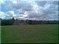
Croft Way Playing Field
In Lower Weedon. The ordnance barracks can be seen in the distance.
Image: © Burgess Von Thunen
Taken: 22 Jul 2010
0.10 miles
2
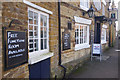
The Maltsters Arms, Weedon
This West Street pub dates from 1877.
Image: © Stephen McKay
Taken: 22 Jan 2017
0.10 miles
3
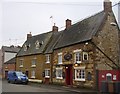
Weedon Bec-The Maltsters Arms
A grade II listed public house in West Street.
Image: © Ian Rob
Taken: 22 Feb 2011
0.13 miles
4
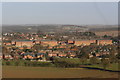
Victorian Barracks
Old Victorian Barrack in Weedon
Image: © Richard Smith
Taken: 19 Dec 2008
0.14 miles
5
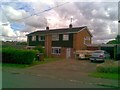
Croft Way
1960s semis in Lower Weedon.
Image: © Burgess Von Thunen
Taken: 22 Jul 2010
0.15 miles
6
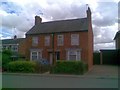
Croft Way
Victorian semis in Lower Weedon.
Image: © Burgess Von Thunen
Taken: 22 Jul 2010
0.15 miles
7
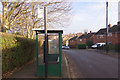
New Croft, Lower Weedon
The bus stop here is served by buses from Daventry heading to Northampton that divert via Weedon village.
Image: © Stephen McKay
Taken: 22 Jan 2017
0.15 miles
8
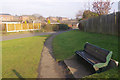
West Street, Lower Weedon
The bench is placed on the bend where Croft Way becomes West Street. In the background are buildings that were once part of the extensive royal ordnance depot.
Image: © Stephen McKay
Taken: 22 Jan 2017
0.15 miles
9
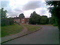
West Street
West Street turns a sharp corner and becomes Croft Way.
Image: © Burgess Von Thunen
Taken: 22 Jul 2010
0.15 miles
10
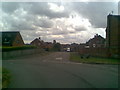
New Croft
The corner of New Croft, Queen Street and Croft Way in Lower Weedon.
Image: © Burgess Von Thunen
Taken: 22 Jul 2010
0.17 miles