
IMAGES TAKEN NEAR TO
Navigation Way, NORTHAMPTON, NN7 4GB
Introduction
This page details the photographs taken nearby to Navigation Way, NN7 4GB by members of the Geograph project.
The Geograph project started in 2005 with the aim of publishing, organising and preserving representative images for every square kilometre of Great Britain, Ireland and the Isle of Man.

There are currently over 7.5m images from over14,400 individuals and you can help contribute to the project by visiting https://www.geograph.org.uk
Image Map
Images are licensed for reuse under creativecommons.org/licenses/by-sa/2.0
Notes
- Clicking on the map will re-center to the selected point.
- The higher the marker number, the further away the image location is from the centre of the postcode.
Image Listing (164 Images Found)
Images are licensed for reuse under creativecommons.org/licenses/by-sa/2.0
Image
Details
Distance
1
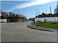
Navigation Way, Weedon Bec
New housing estate built on a former industrial estate, which itself was built on the old canal link into the ordnance depot. I guess this explains the name, "Navigation Way".
Image: © Mr Biz
Taken: 6 May 2013
0.02 miles
2
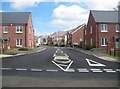
Weedon Bec: Navigation Way
This new housing development is not shown on currently available satellite imagery which shows industrial buildings on the site. The road follows the course of the long lost canal spur from the main Grand Union into the former ordnance depot, hence the name. One cannot help but feel that an opportunity to develop a major tourist and canal attraction by reinstating the link was missed here.
Image: © Nigel Cox
Taken: 3 May 2015
0.04 miles
3
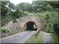
Weedon-Bridge Street
Bridge Street passes under the Grand Union Canal.
Image: © Ian Rob
Taken: 2 Jul 2010
0.04 miles
4
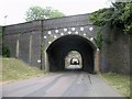
Weedon-Bridge Street
The West Coast Mainline bridge frames the much lower Grand Union Canal bridge.
Image: © Ian Rob
Taken: 2 Jul 2010
0.04 miles
5
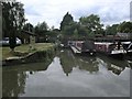
Weedon-Grand Union Canal
Narrowboats moored at the point where the arm from the ordnance depot joined the canal.
Image: © Ian Rob
Taken: 2 Jul 2010
0.04 miles
6
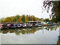
Weedon Bec, boatyard
In an arm of the Grand Union Canal. http://www.williampipernarrowboats.co.uk/about_us.html
Image: © Mike Faherty
Taken: 30 Oct 2011
0.04 miles
7
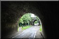
Under the canal
At Weedon Bec, the A5 trunk road, the Grand Union Canal and the West Coast Main Line all run parallel to each other within a few hundred metres. Also unusual is that the canal is on an embankment and the local road tunnels beneath it immediately before it goes under the railway line. This view is from beneath the canal looking west towards the railway bridge. The A5 is a few metres behind the camera.
Image: © Bob Walters
Taken: 18 Jun 2022
0.05 miles
8
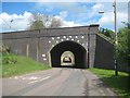
Weedon Bec: Bridge under the West Coast Main Line railway
This bridge takes the West Coast Main Line railway over the road. The 14 white and 1 brown circular plates are the ends of strengthening struts through the bridge. The bridge has no height restriction warning signs, presumably because the Image, which is visible through the arch, is much lower, and narrower. The road is, unsurprisingly, called Bridge Street.
Image: © Nigel Cox
Taken: 3 May 2015
0.05 miles
9
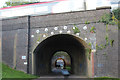
Railway & canal bridges over Bridge Street
Image: © Oast House Archive
Taken: 12 Aug 2016
0.05 miles
10
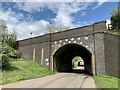
Bridge Street, Weedon Bec
First the bridge for the railway, then the aqueduct for the Grand Union Canal.
Image: © Andrew Abbott
Taken: 17 May 2021
0.05 miles