IMAGES TAKEN NEAR TO
Greenaway Close, NORTHAMPTON, NN7 3EJ
Introduction
This page details the photographs taken nearby to Greenaway Close, NN7 3EJ by members of the Geograph project.
The Geograph project started in 2005 with the aim of publishing, organising and preserving representative images for every square kilometre of Great Britain, Ireland and the Isle of Man.

There are currently over 7.5m images from over14,400 individuals and you can help contribute to the project by visiting https://www.geograph.org.uk
Image Map
Images are licensed for reuse under creativecommons.org/licenses/by-sa/2.0
Notes
- Clicking on the map will re-center to the selected point.
- The higher the marker number, the further away the image location is from the centre of the postcode.
Image Listing (6 Images Found)
Images are licensed for reuse under creativecommons.org/licenses/by-sa/2.0
Image
Details
Distance
3

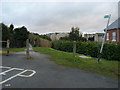
Footbridge over the West Coast Main Line
Taken from the section of footpath just to the north of the bridge.
Image: © Kokai
Taken: 24 Jul 2005
0.16 miles
4

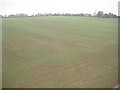
West Coast Main Line
Taken from a footbridge. Train leaving to the north-west.
Image: © Kokai
Taken: 24 Jul 2005
0.16 miles
5
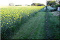
Blisworth: Footpath to Collingtree
This is the view from the top of Image looking back towards Blisworth. The footpath is very faint but can just about be made out as the straight line crossing the tractor tracks at about 45 degrees to them.
Image: © Nigel Cox
Taken: 17 Nov 2013
0.22 miles
6
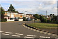
Bridleway down to Stoke Road
Off Courteenhall Road the bridleway down to Stoke Road
Image: © Shaun Ferguson
Taken: 26 Jan 2011
0.23 miles