IMAGES TAKEN NEAR TO
Collingtree Road, NORTHAMPTON, NN7 3AF
Introduction
This page details the photographs taken nearby to Collingtree Road, NN7 3AF by members of the Geograph project.
The Geograph project started in 2005 with the aim of publishing, organising and preserving representative images for every square kilometre of Great Britain, Ireland and the Isle of Man.

There are currently over 7.5m images from over14,400 individuals and you can help contribute to the project by visiting https://www.geograph.org.uk
Image Map
Images are licensed for reuse under creativecommons.org/licenses/by-sa/2.0
Notes
- Clicking on the map will re-center to the selected point.
- The higher the marker number, the further away the image location is from the centre of the postcode.
Image Listing (9 Images Found)
Images are licensed for reuse under creativecommons.org/licenses/by-sa/2.0
Image
Details
Distance
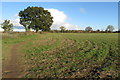
1
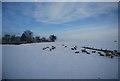
Sheep by the Rugby - Northampton Railway line
Image: © N Chadwick
Taken: 19 Dec 2010
0.04 miles
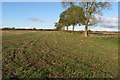
2
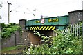
Low bridge
Bridge No. 7 on the Northampton Loop Line at Milton Malsor has a large warning sign painted on it to warn overheight vehicles.
Image: © Bob Walters
Taken: 18 Jun 2022
0.06 miles
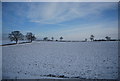
3
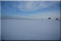
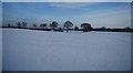
A snowscene by the Rugby - Northampton Railway line
Image: © N Chadwick
Taken: 19 Dec 2010
0.14 miles