
IMAGES TAKEN NEAR TO
Station Road, NORTHAMPTON, NN7 1NH
Introduction
This page details the photographs taken nearby to Station Road, NN7 1NH by members of the Geograph project.
The Geograph project started in 2005 with the aim of publishing, organising and preserving representative images for every square kilometre of Great Britain, Ireland and the Isle of Man.

There are currently over 7.5m images from over14,400 individuals and you can help contribute to the project by visiting https://www.geograph.org.uk
Image Map
Images are licensed for reuse under creativecommons.org/licenses/by-sa/2.0
Notes
- Clicking on the map will re-center to the selected point.
- The higher the marker number, the further away the image location is from the centre of the postcode.
Image Listing (30 Images Found)
Images are licensed for reuse under creativecommons.org/licenses/by-sa/2.0
Image
Details
Distance
4
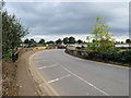
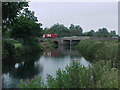
The Causeway
Crossing the River Nene at Great Billing.
Image: © David Dixon
Taken: 20 Oct 2019
0.08 miles
8
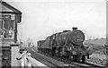
Goods train bound for Northampton at Billing
View eastward, towards Wellingborough: ex-LNW Northampton - Wellingborough - Peterborough line. Billing station (behind the camera) had been closed in 9/52, but the line remained open for passengers until 5/64 and for freight until 1972. The short Class J goods is headed by Stanier 8F 2-8-0 No. 48147 (built 1942, withdrawn 7/66).
Image: © Ben Brooksbank
Taken: 1 May 1965
0.10 miles
9
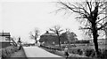
Billing Station (remains)
View southward over level-crossing; Northampton - Wellingborough - Peterborough secondary main line: Wellingborough (left), Northampton (right), closed 4/5/64. (Billing station had been closed to passengers 6/10/52). (My wife is striding ahead).
Image: © Ben Brooksbank
Taken: 1 May 1965
0.11 miles
10

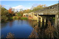
Public House, Bridge and the Nene River
The Billing Mill Public House is to the left and the bridge to the right allows access for traffic from Billing Road.
Image: © Kokai
Taken: 16 May 2006
0.13 miles