
IMAGES TAKEN NEAR TO
Stonehill Way, NORTHAMPTON, NN6 9LW
Introduction
This page details the photographs taken nearby to Stonehill Way, NN6 9LW by members of the Geograph project.
The Geograph project started in 2005 with the aim of publishing, organising and preserving representative images for every square kilometre of Great Britain, Ireland and the Isle of Man.

There are currently over 7.5m images from over14,400 individuals and you can help contribute to the project by visiting https://www.geograph.org.uk
Image Map
Images are licensed for reuse under creativecommons.org/licenses/by-sa/2.0
Notes
- Clicking on the map will re-center to the selected point.
- The higher the marker number, the further away the image location is from the centre of the postcode.
Image Listing (27 Images Found)
Images are licensed for reuse under creativecommons.org/licenses/by-sa/2.0
Image
Details
Distance
1
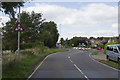
Looking towards Brixworth
Standing on the Northampton Road this is a view towards Brixworth. New housing is on the right hand side of the picture, though even some of this has been there quite a while.
Image: © Malcolm Neal
Taken: 10 Aug 2017
0.07 miles
2
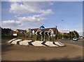
Little roundabout on Northampton Road, Brixworth
Image: © David Howard
Taken: 21 May 2017
0.08 miles
3
Far Brook
Looking over the fence to Northampton Road.
Image: © Burgess Von Thunen
Taken: 26 Jul 2010
0.10 miles
4
The Ashway
Roundabout at the junction of The Ashway and Northampton Road.
Image: © Burgess Von Thunen
Taken: 26 Jul 2010
0.10 miles
5
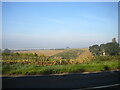
Fields west of Northampton Road, Brixworth
To the south west of the village, showing the rolling topography of this part of Northamptonshire.
Image: © Richard Vince
Taken: 9 Oct 2021
0.11 miles
6
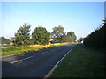
Northampton Road, Brixworth
Entering the village from the south. At this point, there is only housing on the right (behind the hedge).
Image: © Richard Vince
Taken: 9 Oct 2021
0.12 miles
7
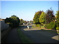
The Ashway, Brixworth (2)
Approaching the roundabout at which it meets Northampton Road.
Image: © Richard Vince
Taken: 9 Oct 2021
0.13 miles
8
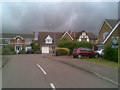
Far Brook
1990s houses in Brixworth.
Image: © Burgess Von Thunen
Taken: 26 Jul 2010
0.13 miles
9
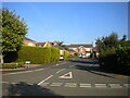
Far Brook, Brixworth
A T shaped cul de sac off The Ashway.
Image: © Richard Vince
Taken: 9 Oct 2021
0.14 miles
10
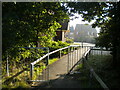
Footpath to Hawthorn Road, Brixworth
Off Northampton Road.
Image: © Richard Vince
Taken: 9 Oct 2021
0.15 miles