
IMAGES TAKEN NEAR TO
Bartlets Well, NORTHAMPTON, NN6 9FQ
Introduction
This page details the photographs taken nearby to Bartlets Well, NN6 9FQ by members of the Geograph project.
The Geograph project started in 2005 with the aim of publishing, organising and preserving representative images for every square kilometre of Great Britain, Ireland and the Isle of Man.

There are currently over 7.5m images from over14,400 individuals and you can help contribute to the project by visiting https://www.geograph.org.uk
Image Map
Images are licensed for reuse under creativecommons.org/licenses/by-sa/2.0
Notes
- Clicking on the map will re-center to the selected point.
- The higher the marker number, the further away the image location is from the centre of the postcode.
Image Listing (58 Images Found)
Images are licensed for reuse under creativecommons.org/licenses/by-sa/2.0
Image
Details
Distance
2
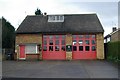
Brixworth fire station
Brixworth fire station, Holcot Road, Brixworth, Northamptonshire
Image: © Kevin Hale
Taken: 5 Dec 2007
0.05 miles
4

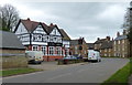
Lane off Holcot Road, Brixworth
Leading down past the village hall to Northampton Road.
Image: © Richard Vince
Taken: 9 Oct 2021
0.06 miles
5
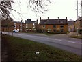
Harborough Road
Brick and stone houses in Brixworth.
Image: © Burgess Von Thunen
Taken: 19 Mar 2013
0.06 miles
6
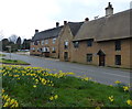
Daffodils along Harborough Road in Brixworth
Looking towards the Coach & Horses public house.
Image: © Mat Fascione
Taken: 19 Mar 2017
0.06 miles
7
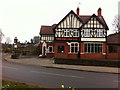
The Red Lion Inn
Public house on Harborough Road.
Image: © Burgess Von Thunen
Taken: 19 Mar 2013
0.06 miles
8
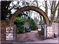
Northampton Road
An archway which may have been an entrance to Brixworth Hall park.
Image: © Burgess Von Thunen
Taken: 19 Mar 2013
0.07 miles
9
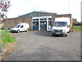
Telephone Exchange, Brixworth
Situated in Holcot Road, this TE, of a standard design dating from the late 1960s, would have replaced a smaller building in the village at that time. It has the code EMBRIXW and provides telephone and broadband services to 2,426 residential and 124 non-residential premises in Brixworth, plus Pitsford and Scaldwell nearby. Two BT Openreach vehicles can be seen parked in front of this TE. The numbering range of this TE is (01604) 88xxxx, the (01604) referring to the Northampton group of twenty TEs, and its postcode is NN6 9BS.
Image: © David Hillas
Taken: 25 Apr 2015
0.07 miles
10
Public footpath to Holcot Road, Brixworth
Image: © Richard Vince
Taken: 9 Oct 2021
0.07 miles