IMAGES TAKEN NEAR TO
Cottesbrooke, NORTHAMPTON, NN6 8PG
Introduction
This page details the photographs taken nearby to NN6 8PG by members of the Geograph project.
The Geograph project started in 2005 with the aim of publishing, organising and preserving representative images for every square kilometre of Great Britain, Ireland and the Isle of Man.

There are currently over 7.5m images from over14,400 individuals and you can help contribute to the project by visiting https://www.geograph.org.uk
Image Map
Images are licensed for reuse under creativecommons.org/licenses/by-sa/2.0
Notes
- Clicking on the map will re-center to the selected point.
- The higher the marker number, the further away the image location is from the centre of the postcode.
Image Listing (31 Images Found)
Images are licensed for reuse under creativecommons.org/licenses/by-sa/2.0
Image
Details
Distance
1
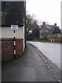
Pre-Worboys sign on Main Street, Cottesbrooke
As I only found this from this site it's safe to add it. I don't know any more for at least a couple of hundred miles north and beyond.
Image: © David Howard
Taken: 2 Jul 2019
0.01 miles
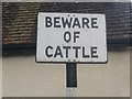
2
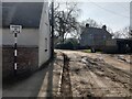
Cattle warning sign
An old black and white road warning sign in Cottesbroke
Image: © Michael Trolove
Taken: 8 Jan 2017
0.02 miles
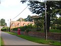
6
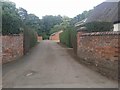
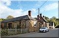
Cottesbrooke Cottages
Cottages on the main road through the village.
Image: © Ian Rob
Taken: 5 Sep 2006
0.03 miles
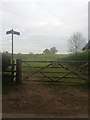
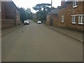
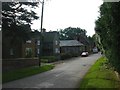
7
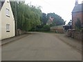
Cottesbrooke
The Main Street through the village.
Image: © Ian Rob
Taken: 5 Sep 2006
0.03 miles