
IMAGES TAKEN NEAR TO
Horseshoe Close, NORTHAMPTON, NN6 8NW
Introduction
This page details the photographs taken nearby to Horseshoe Close, NN6 8NW by members of the Geograph project.
The Geograph project started in 2005 with the aim of publishing, organising and preserving representative images for every square kilometre of Great Britain, Ireland and the Isle of Man.

There are currently over 7.5m images from over14,400 individuals and you can help contribute to the project by visiting https://www.geograph.org.uk
Image Map
Images are licensed for reuse under creativecommons.org/licenses/by-sa/2.0
Notes
- Clicking on the map will re-center to the selected point.
- The higher the marker number, the further away the image location is from the centre of the postcode.
Image Listing (34 Images Found)
Images are licensed for reuse under creativecommons.org/licenses/by-sa/2.0
Image
Details
Distance
1
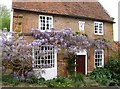
Cottage in High Street, Creaton
Unusually of brick rather than the local ironstone, this cottage perhaps ought to be called Wisteria Cottage. Note the sundial above the door, with the initials TA, presumably the builder.
Image: © Graham Horn
Taken: 25 Apr 2007
0.03 miles
2
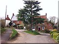
Creaton
Cottages on the corner of High Street and Horseshoe Close.
Image: © Burgess Von Thunen
Taken: 21 Apr 2013
0.04 miles
3
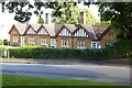
Houses in Creaton
Houses overlooking the Green in Creaton.
Image: © Philip Halling
Taken: 17 Aug 2023
0.04 miles
4
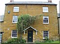
Creaton, The Old Bakery
This lovely ironstone house is named The Old Bakery. So presumably that's what it was.
Image: © Graham Horn
Taken: 25 Apr 2007
0.05 miles
5
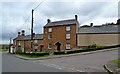
Creaton Cottages
On the corner of High Street.
Image: © Ian Rob
Taken: 13 Oct 2015
0.06 miles
6
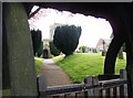
St. Michael and All Angels church Creaton
Looking through the lych gate from the north side of the church.
Image: © Graham Horn
Taken: 25 Apr 2007
0.07 miles
8
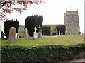
St. Michael and All Angels church Creaton
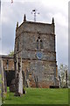
The church dates from the 12th century, although now only the north doorway remains. The tower is 14th century. It is built above the surrounding land.
Image: © Graham Horn
Taken: 25 Apr 2007
0.07 miles
10
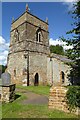
The tower of Creaton church
The church of St Michael, Creaton dates from the 12th century and is Grade II* listed, see: https://historicengland.org.uk/listing/the-list/list-entry/1067105?section=official-list-entry
Image: © Philip Halling
Taken: 17 Aug 2023
0.09 miles