
IMAGES TAKEN NEAR TO
Smith Street, NORTHAMPTON, NN6 8HW
Introduction
This page details the photographs taken nearby to Smith Street, NN6 8HW by members of the Geograph project.
The Geograph project started in 2005 with the aim of publishing, organising and preserving representative images for every square kilometre of Great Britain, Ireland and the Isle of Man.

There are currently over 7.5m images from over14,400 individuals and you can help contribute to the project by visiting https://www.geograph.org.uk
Image Map
Images are licensed for reuse under creativecommons.org/licenses/by-sa/2.0
Notes
- Clicking on the map will re-center to the selected point.
- The higher the marker number, the further away the image location is from the centre of the postcode.
Image Listing (73 Images Found)
Images are licensed for reuse under creativecommons.org/licenses/by-sa/2.0
Image
Details
Distance
1

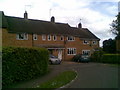
Smith Street
1930's council houses.
Image: © Burgess Von Thunen
Taken: 25 Mar 2010
0.04 miles
2

Smith Street
An 18th century cottage.
Image: © Burgess Von Thunen
Taken: 20 May 2010
0.04 miles
3
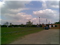
Spratton Recreation Ground
The site of a summer folk festival in recent years.
Image: © Burgess Von Thunen
Taken: 7 May 2010
0.05 miles
6

Spratton Folk Festival
The main stage at Spratton Folk Festival in 2009. A wonderful small festival that only lasted three or four years, but had some amazing top line bands.
Image: © Malcolm Neal
Taken: 12 Jul 2009
0.06 miles
8
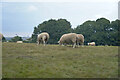
We must eat the grass
There were many sheep all concentrating on eating as much grass as possible.
Image: © Malcolm Neal
Taken: 12 Sep 2021
0.09 miles
9
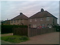
Welford Road
1950s council houses.
Image: © Burgess Von Thunen
Taken: 5 May 2010
0.10 miles
10
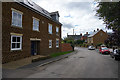
School Road
School Road in Spratton is aptly named as it has a Church of England Primary School and a public School Spratton Hall along its length.
Image: © Malcolm Neal
Taken: 26 Aug 2020
0.11 miles