
IMAGES TAKEN NEAR TO
Monks Way, NORTHAMPTON, NN6 7XB
Introduction
This page details the photographs taken nearby to Monks Way, NN6 7XB by members of the Geograph project.
The Geograph project started in 2005 with the aim of publishing, organising and preserving representative images for every square kilometre of Great Britain, Ireland and the Isle of Man.

There are currently over 7.5m images from over14,400 individuals and you can help contribute to the project by visiting https://www.geograph.org.uk
Image Map
Images are licensed for reuse under creativecommons.org/licenses/by-sa/2.0
Notes
- Clicking on the map will re-center to the selected point.
- The higher the marker number, the further away the image location is from the centre of the postcode.
Image Listing (122 Images Found)
Images are licensed for reuse under creativecommons.org/licenses/by-sa/2.0
Image
Details
Distance
1
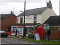
Crick
At the eastern edge of Village on road to West Haddon.
Image: © Ian Rob
Taken: 1 Oct 2005
0.06 miles
2
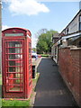
Crick: a red phone box
This traditional K6 telephone box stands just a couple of yards from Image, on Main Road.
Image: © Chris Downer
Taken: 7 May 2013
0.07 miles
3
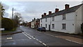
Houses in Crick
Houses on the road leaving Crick to the east.
Image: © Peter Mackenzie
Taken: 26 Nov 2019
0.07 miles
4
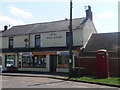
Crick: the post office
The newsagent and post office is situated on Main Road, to the east of the village centre.
Image: © Chris Downer
Taken: 7 May 2013
0.07 miles
5
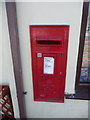
Crick: postbox № NN6 232
This George VI-reign postbox is set into the wall of Image
Image: © Chris Downer
Taken: 7 May 2013
0.07 miles
6
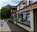
Crick Post Office & Stores
On the Main Road of Crick village.
Image: © Mat Fascione
Taken: 25 Jul 2015
0.07 miles
7
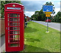
Telephone box on the Main Road of Crick
Image: © Mat Fascione
Taken: 25 Jul 2015
0.07 miles
8
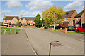
Bury Dyke, Crick
Modern detached houses at the eastern end of Crick village, close to the primary school. It is worth noting that Crick's population increased by more than 25% between 2001 and 2011.
Image: © Stephen McKay
Taken: 17 Oct 2017
0.08 miles
9
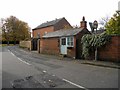
Crick-The Marsh
Ladies and Gents Hairdresser with the Chapel in the background.
Image: © Ian Rob
Taken: 26 Oct 2012
0.08 miles
10
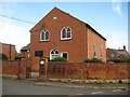
Crick: United Reformed Chapel
The chapel is, unsurprisingly, on Chapel Lane and is a Grade II Listed Building. The English Heritage website describes it thus:-
"Chapel. Datestone 1820. Brick (Flemish bond). Central doorway in arched brick frame has overlight with Y-tracery and C20 door. 2 windows above with arched brick frames and Y-tracery. Interior: the fittings are late C19. Formerly a Congregational Chapel."
Image: © Nigel Cox
Taken: 8 May 2015
0.10 miles